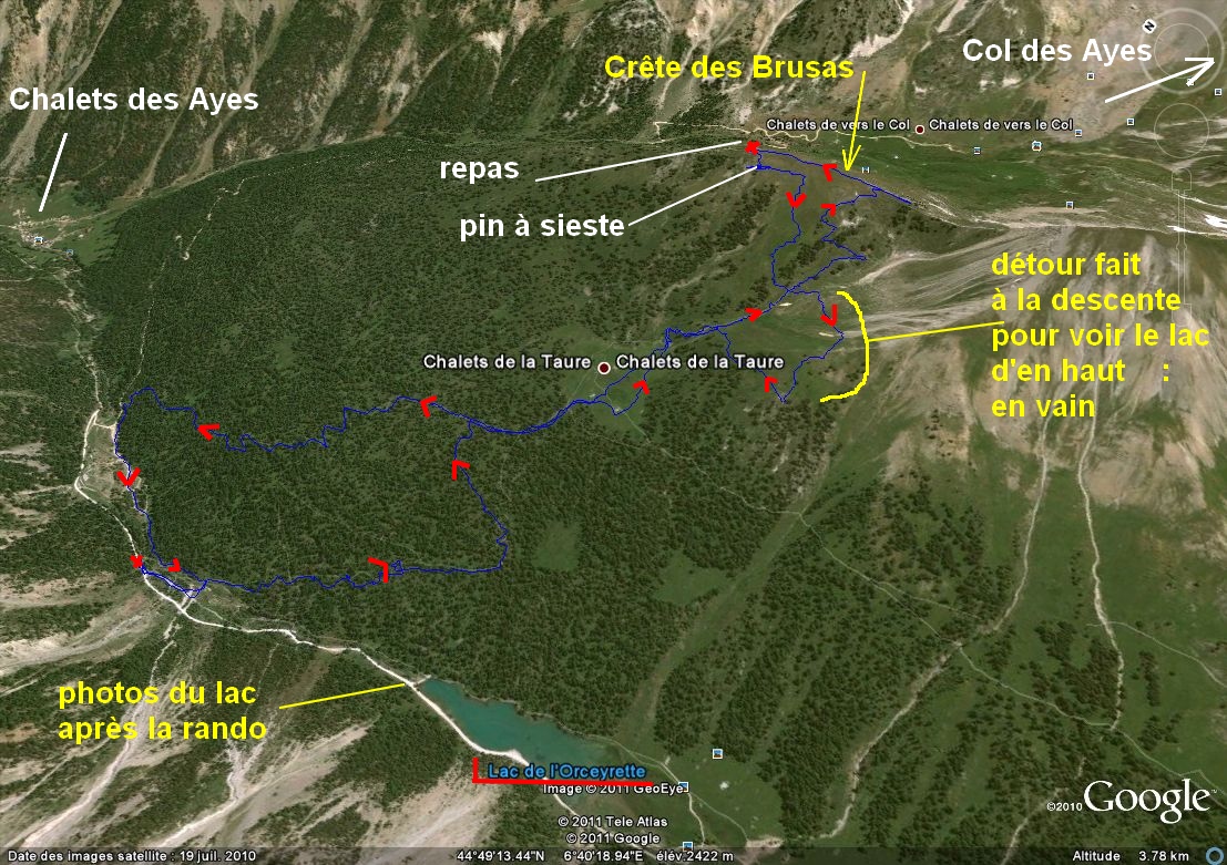
Crętes des Brusas –
Villard St Pancrace (05) - - - 23/08/11
________ ici
il n'y a que
les imagettes ,
si une ou plusieurs photos vous intéressent en
grand format ,
merci de me faire un mail
Pour
les noms
des sommets ,
on
peut dire qu'ils sont bons
ŕ 90% ,
s'il y a erreur, ŕ vous de corriger, au moins vous avez la
direction !
Toute remarque constructive pour corriger les plus grosses
erreurs ici sera acceptée par bnbd05@yahoo.fr merci
Retour
Page Liste des Randos
* * * * * *
Attention
: d'abords un rappel
EN MONTAGNE, CHACUN
EST RESPONSABLE DE SA SÉCURITÉ .
Elle requiert également la conscience de ses propres capacités et de
ses limites propres, et implique par conséquent l'acceptation d'un
certain degré de risque. Par conséquent, les randonnées se font
sous votre propre responsabilité. L'auteur de ce site ne peut pas
garantir l'exactitude ni l'exhaustivité des indications contenues dans
ce site.
* * * * * *
2 autres petits conseils :
que l'on veuille prendre des photos ou juste regarder :on arręte d'abords
de marcher
quand la marche avant n'est pas aisée ,
la marche
arričre peut ętre salutaire
* * * * * *
*
* * * * *
* * * * * *
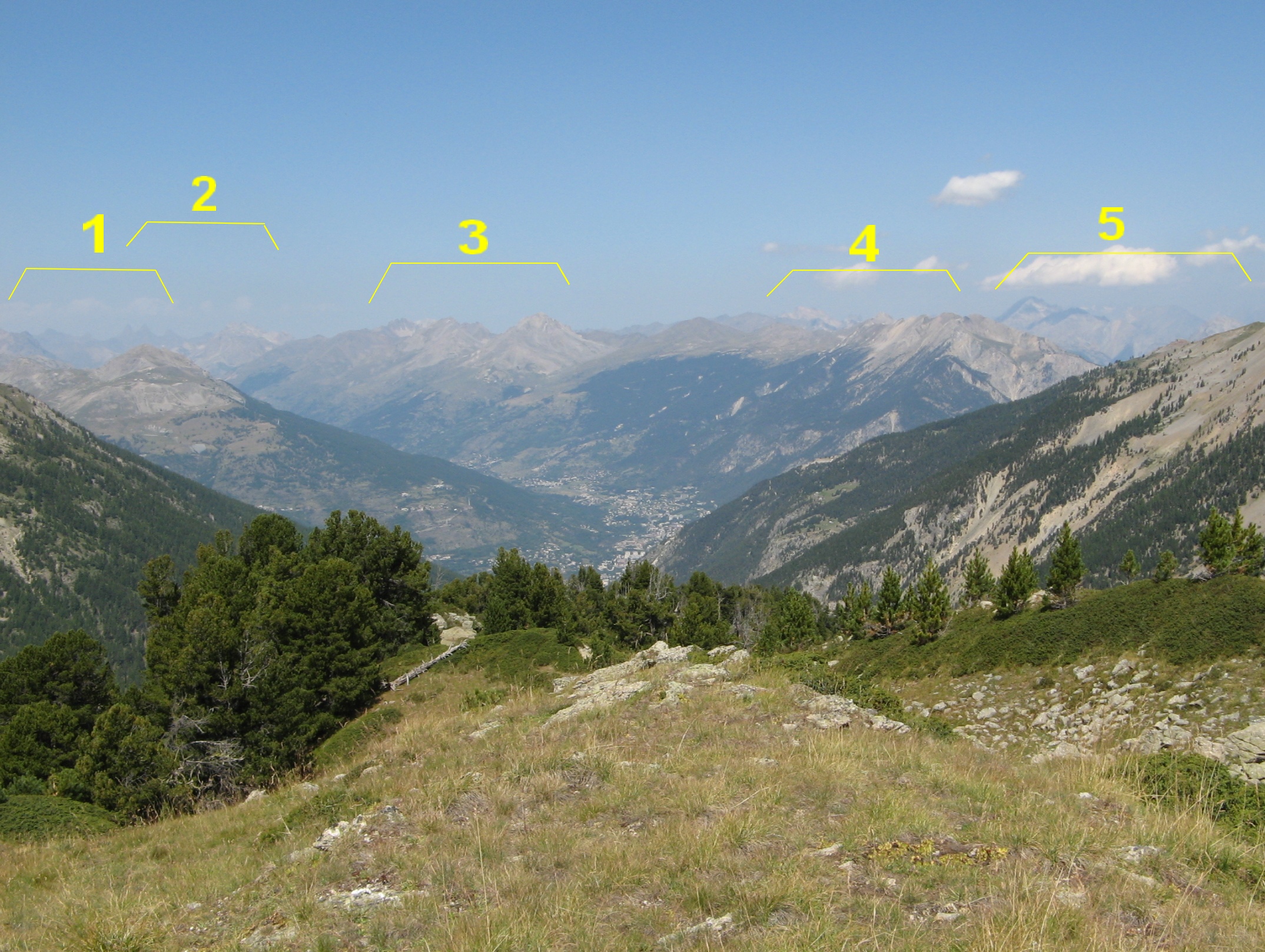
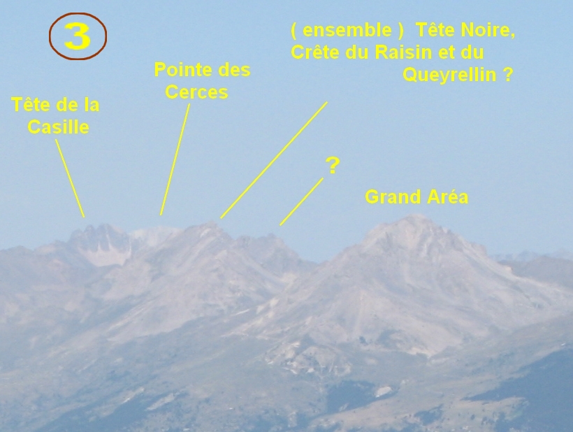
quelques zooms
idem
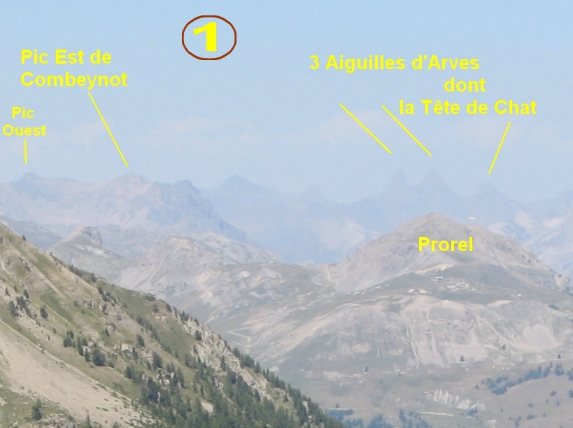
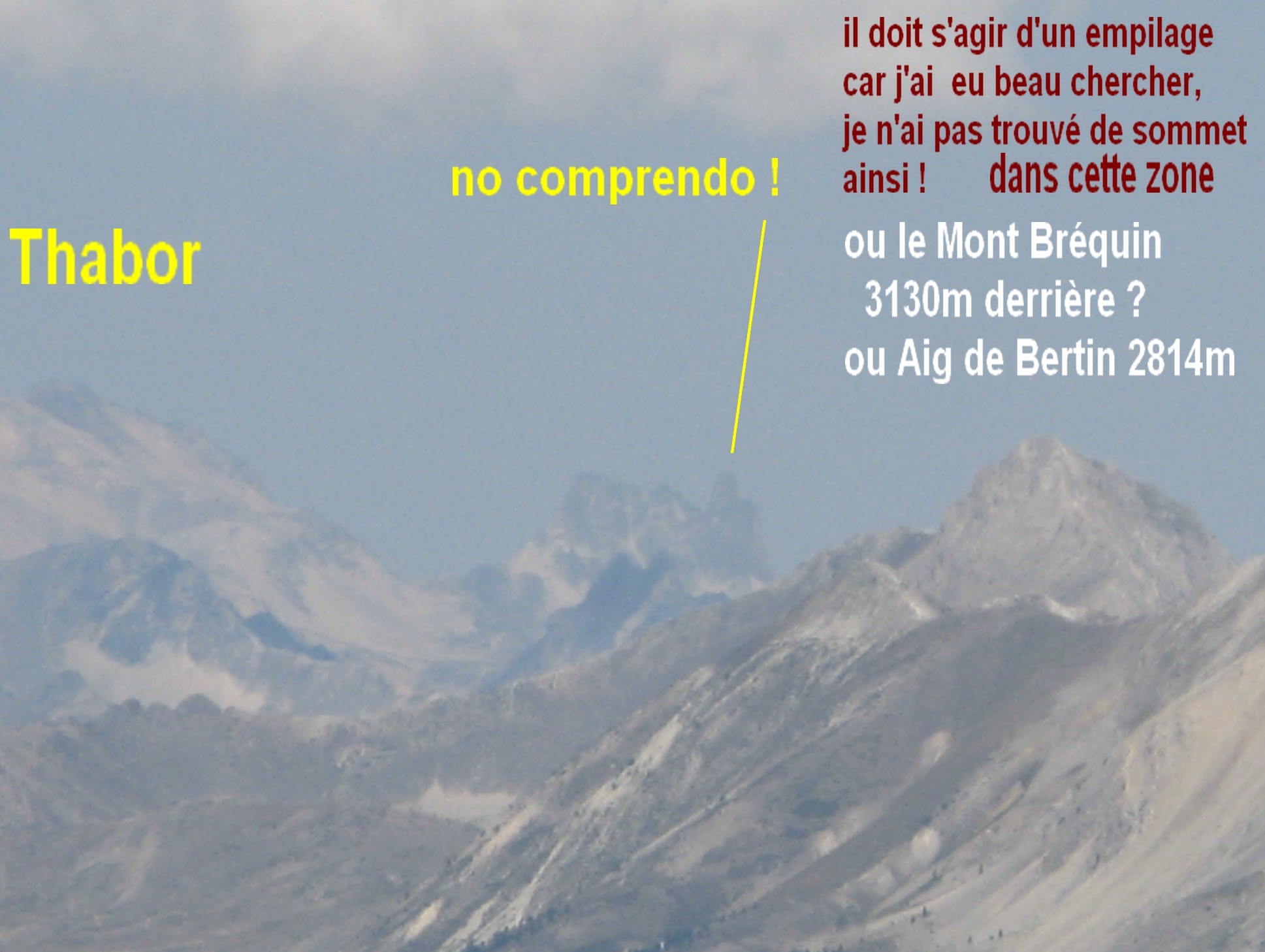
les Aiguilles
d'Arve au centre dans la brume et en revenant sur la Cucumelle le Combeynot ?
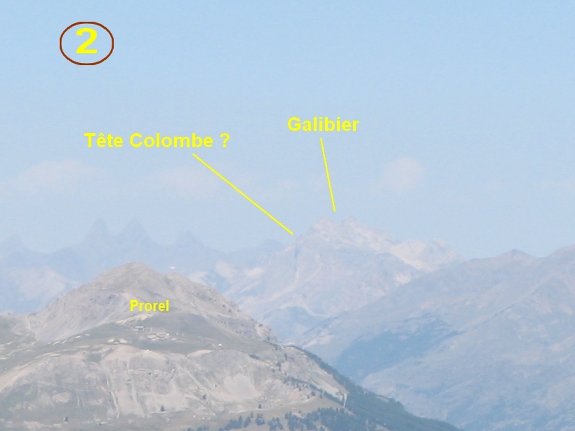
logiquement, au
centre d. le premier serait le Grand Aréa et, ŕ droite des Aiguilles
d'Arve, le Galibier
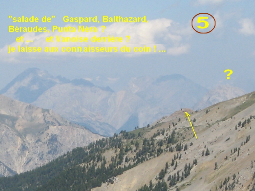
et au centre,
au fond, comme on a vu 3 ou 4 glaciers, ce doit ętre La Vanoise
ŕ nouveau,
Briançon
zooms tentés
malgré la brume, ŕ g. un bout de Cucumelle et Combeynot ?
les Aiguilles
d'Arve
ça, ?
............
ça aussi
c'était trčs beau mais ?
le Grand Aréa
et ça donc
??? ŕ d.
avec la belle
aiguille noire au centre g.
et ça vers la
Vanoise ? ( ŕ moins qu'on ne soit gourmands et que ce ne soit que
dans les Cerces ? )
c'est l'heure
de la sieste pour moi, JP a pris de l'avance, comme d'hab !
le "pin ŕ
sieste" au re-décollage
vers 2300m, une
plage !
.............. et un touriste !
un coup d'oeil
vers le passé
on veut voir le
lac du haut ....
les Chalets de
l'Alp au bout, oui
mais le
lac : macache !, on va descendre vers les rochers ŕ d. mais
oualou !
magnifique pin
cembro
on rentre ...
de nouveau aux
Chalets de La Taure
gentiane
croisette
fin des images
de la rando
mais on ne
pouvait partir sans voir quelle mine avait le Lac de l'Orceyrette
belle pičce
d'eau
on reviendra
peut-ętre dans le coin ...
------------------------------
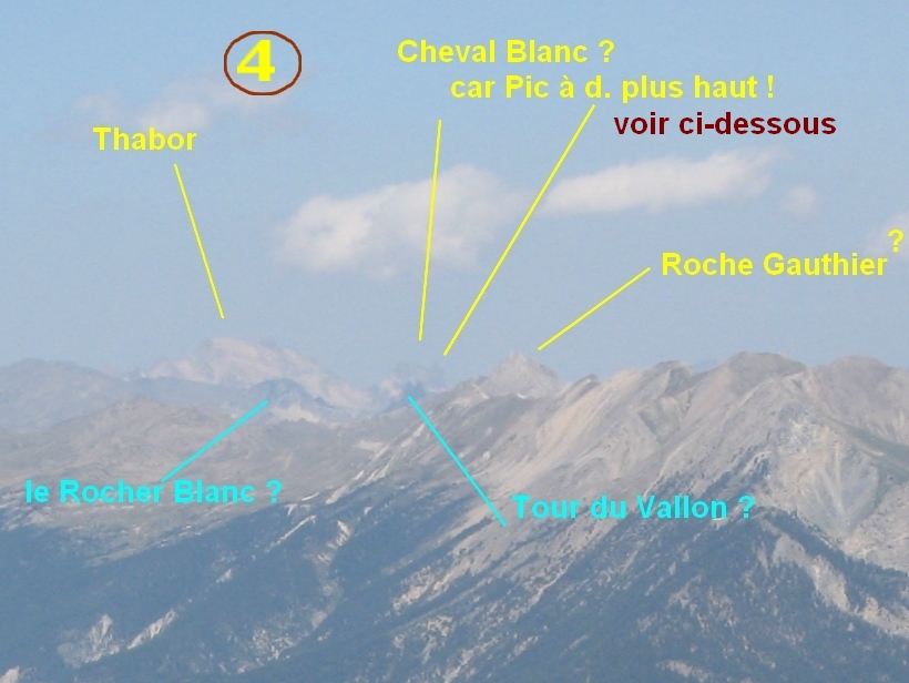
dommage pour la brume !Tęte de la Cassille !belle pointe vue au "Cheval Blanc" ou supposé comme tel
Page générée le 24/08/2011
website tracker widget