| - Canon PS A710 (200x) | |
Cette balade magnifique est agrémentée de quelques panoramas, qui sont, hélas, en java ! |
Pour profiter de ces panoramas, seul le navigateur Internet Explorer les autorise encore, ( au 18/05/2018 ... ) je vous encourage donc à l'utiliser, au moins pour ces panos ( comme pour les panos isolés, en bas de page d'accueil ) |
IMG_0694.JPG (1.37 MO) 2592 x 1944 tout de suite : la vedette, le Brec de Chambeyron ----> |
IMG_0695.JPG (1.55 MO) 2592 x 1944 |
IMG_0696.JPG (1.66 MO) 2592 x 1944 |
IMG_0697.JPG (2.4 MO) 2592 x 1944 là je pense être reparti à g. du Brec <----- |
IMG_0698.JPG (2.09 MO) 2592 x 1944 vers la Mortice à l'arrière |
IMG_0699.JPG (2.03 MO) 2592 x 1944 |
IMG_0700.JPG (1.95 MO) 2592 x 1944 jusqu'au Paneyron ... |
IMG_0701.JPG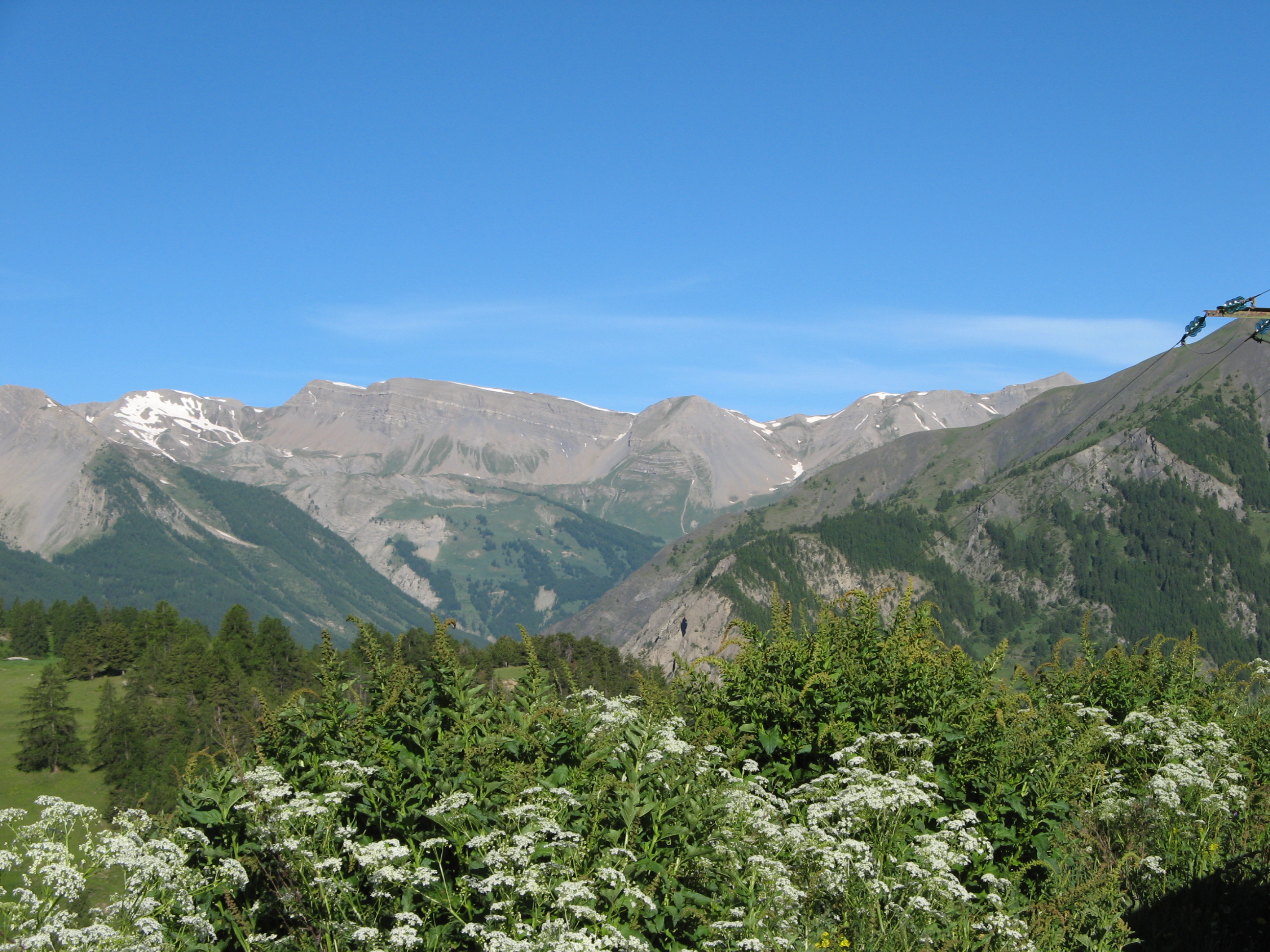 (2.37 MO) 2592 x 1944 @ et plus : ici, je crois, du fond du Vallon du Crachet ( à g. enneigé ) et le petit col au Lac Lalatcha jusqu'au col du Crachet au 1/3 d. ( après la bosse 2734 ) |
IMG_0702.JPG (2.25 MO) 2592 x 1944 on rajoute ici les Rochers de Mièjour au centre et le groupe Gde Combe, Vallon Claous - Infernet et Cassoun vers nous |
IMG_0703.JPG (1.74 MO) 2592 x 1944 |
IMG_0704.JPG (2.24 MO) 2592 x 1944 le Rognon sans doute aux premiers plans |
IMG_0705.JPG (2.41 MO) 2592 x 1944 |
IMG_0706.JPG (2.83 MO) 2592 x 1944 |
IMG_0707.JPG (2.26 MO) 2592 x 1944 |
IMG_0708.JPG (2.74 MO) 2592 x 1944 |
IMG_0709.JPG (2.21 MO) 2592 x 1944 le Paneyron au centre |
IMG_0710.JPG (1.58 MO) 2592 x 1944 anémones à fleurs de narcisse, dixit JP |
IMG_0711.JPG (1.76 MO) 1944 x 2592 |
IMG_0712.JPG (2.21 MO) 2592 x 1944 |
IMG_0713.JPG (2.63 MO) 1944 x 2592 |
IMG_0714.JPG (2.03 MO) 2592 x 1944 la Pointe de l'Eyssina |
IMG_0715.JPG (2.64 MO) 2592 x 1944 |
IMG_0716.JPG (2.43 MO) 2592 x 1944 |
IMG_0717.JPG (2.23 MO) 2592 x 1944 |
IMG_0718.JPG (2.64 MO) 2592 x 1944 ---> vers le Brec |
IMG_0719.JPG (2.9 MO) 2592 x 1944 |
IMG_0720.JPG (2.55 MO) 2592 x 1944 |
IMG_0721.JPG (2.37 MO) 2592 x 1944 |
IMG_0722.JPG (2.49 MO) 2592 x 1944 |
IMG_0723.JPG (2.17 MO) 2592 x 1944 ---> qui pointe son nez derrière le Replat des Génisses |
IMG_0724.JPG (2.81 MO) 2592 x 1944 ---> stop |
IMG_0725.JPG (2.16 MO) 2592 x 1944 je pense que l'Aiguille de Chambeyron est cachée par là, un bout de la Pointe d'Aval ( en arrière ) ici ? |
IMG_0726.JPG (1.73 MO) 2592 x 1944 |
IMG_0727.JPG (2.97 MO) 2592 x 1944 belles pensées blanches au casse-croûte vers Pralouyer |
IMG_0728.JPG (1.57 MO) 2592 x 1944 |
IMG_0729.JPG (1.58 MO) 2592 x 1944 je cherche vers le Pic St André, Jaffueil et le Pic de Chabrières centre droit |
IMG_0730.JPG (1.94 MO) 2592 x 1944 |
IMG_0731.JPG (2.94 MO) 2592 x 1944 toujours au casse - croute, le col sans nom se découvre au fond à d. |
IMG_0732.JPG (2.66 MO) 2592 x 1944 |
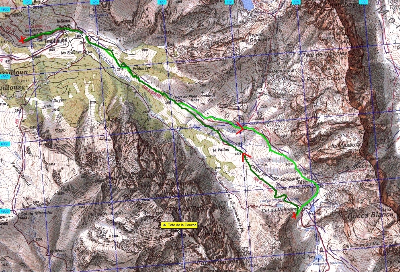
IMG_0733.JPG (2.61 MO) 2592 x 1944 on arrive dans le coin des ruines du Fort de Plate Lombarde |
IMG_0734.JPG (2.9 MO) 2592 x 1944 |
IMG_0735.JPG (3.32 MO) 2592 x 1944 |
IMG_0736.JPG (2.42 MO) 2592 x 1944 on va continuer sur la trace vue ici mais le GR de pays a été tracé au-dessus |
IMG_0737.JPG (4.05 MO) 2592 x 1944 |
IMG_0738.JPG (2.96 MO) 2592 x 1944 xxxxx on ne sait pas : une sorte de lin ? |
IMG_0739.JPG (1.92 MO) 1944 x 2592 |
IMG_0740.JPG (1.85 MO) 2592 x 1944 |
IMG_0741.JPG (1.89 MO) 2592 x 1944 |
IMG_0742.JPG (3.21 MO) 2592 x 1944 cuspide d'or |
IMG_0743.JPG (1.87 MO) 2592 x 1944 |
IMG_0744.JPG (2.46 MO) 2592 x 1944 |
IMG_0745.JPG (2.56 MO) 2592 x 1944 |
IMG_0746.JPG (2.39 MO) 2592 x 1944 |
IMG_0747.JPG (2.17 MO) 2592 x 1944 on va grimper à gauche pour retrouver le PR devenu GR de Pays |
IMG_0748.JPG (1.96 MO) 2592 x 1944 au fond à d. un bout de la Meyna .... on verra ... |
IMG_0749.JPG (2.06 MO) 2592 x 1944 et, à g. , le Massour et Rocca Blanca à d. |
IMG_0750.JPG (2.64 MO) 2592 x 1944 @ on va arriver au carrefour du Vallon des Aoupets panneau au dessus du centre g. du premier rocher ----> |
IMG_0751.JPG (2.45 MO) 2592 x 1944 |
IMG_0752.JPG (2.31 MO) 2592 x 1944 |
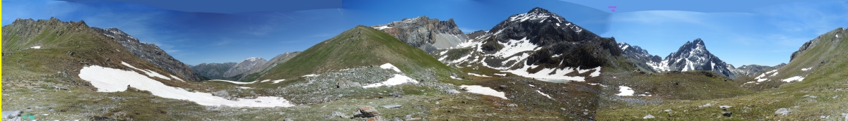
IMG_0753.JPG  (2.26 MO) 2592 x 1944 pano 750 à 753 à voir plus loin |
IMG_0754.JPG (1.79 MO) 2592 x 1944 ---> stop la Meyna un peu mieux ! |
IMG_0755.JPG (2.34 MO) 2592 x 1944 vers le Brec |
IMG_0756.JPG (2.49 MO) 2592 x 1944 |
IMG_0757.JPG (2.42 MO) 2592 x 1944 et je reprends le tour vers la droite ( les Rochers de St Ours ) ---> |
IMG_0758.JPG (2.44 MO) 2592 x 1944 |
IMG_0759.JPG (2.61 MO) 2592 x 1944 la Tête des Bréquets ici peut-être ? |
IMG_0760.JPG (2.66 MO) 2592 x 1944 et Tête de la Courbe là ? |
IMG_0761.JPG (2.49 MO) 2592 x 1944 |
IMG_0762.JPG (2.17 MO) 2592 x 1944 ---> stop |
IMG_0763.JPG (2.31 MO) 2592 x 1944 au centre, le Massour qui m'a fasciné sous un autre angle, mais déjà très beau ici |
IMG_0764.JPG (1.69 MO) 2592 x 1944 des anémones souffrées |
IMG_0765.JPG (1.94 MO) 2592 x 1944 |
IMG_0766.JPG (1.44 MO) 2592 x 1944 |
IMG_0767.JPG (1.56 MO) 2592 x 1944 |
IMG_0768.JPG (2.14 MO) 2592 x 1944 |
IMG_0769.JPG (2.14 MO) 2592 x 1944 |
IMG_0770.JPG (1.58 MO) 2592 x 1944 @ vers Vars |
IMG_0771.JPG (2.32 MO) 2592 x 1944 |
IMG_0772.JPG (970 KO) 2592 x 1944 |
IMG_0773.JPG (2.62 MO) 2592 x 1944 le Massour ça vient ! et les tapis de fleurs tout autour de nous |
IMG_0774.JPG (3.66 MO) 2592 x 1944 |
IMG_0775.JPG (3.12 MO) 2592 x 1944 |
IMG_0776.JPG (2.93 MO) 2592 x 1944 |
IMG_0777.JPG (2.91 MO) 2592 x 1944 |
IMG_0778.JPG (2.92 MO) 2592 x 1944 |
IMG_0779.JPG (2.78 MO) 2592 x 1944 |
IMG_0780.JPG (2.85 MO) 2592 x 1944 |
IMG_0781.JPG (2.74 MO) 1944 x 2592 et là !!! |
IMG_0782.JPG (1.59 MO) 1944 x 2592 joli ! |
IMG_0783.JPG (2 MO) 2592 x 1944 pédiculaire |
IMG_0784.JPG (1.88 MO) 1944 x 2592 |
IMG_0785.JPG (2.26 MO) 2592 x 1944 |
IMG_0786.JPG (1.76 MO) 1944 x 2592 |
IMG_0787.JPG (1.67 MO) 2592 x 1944 les soldanelles sont nombreuses près des névés |
IMG_0788.JPG (2.8 MO) 2592 x 1944 |
IMG_0789.JPG (2.72 MO) 2592 x 1944 |
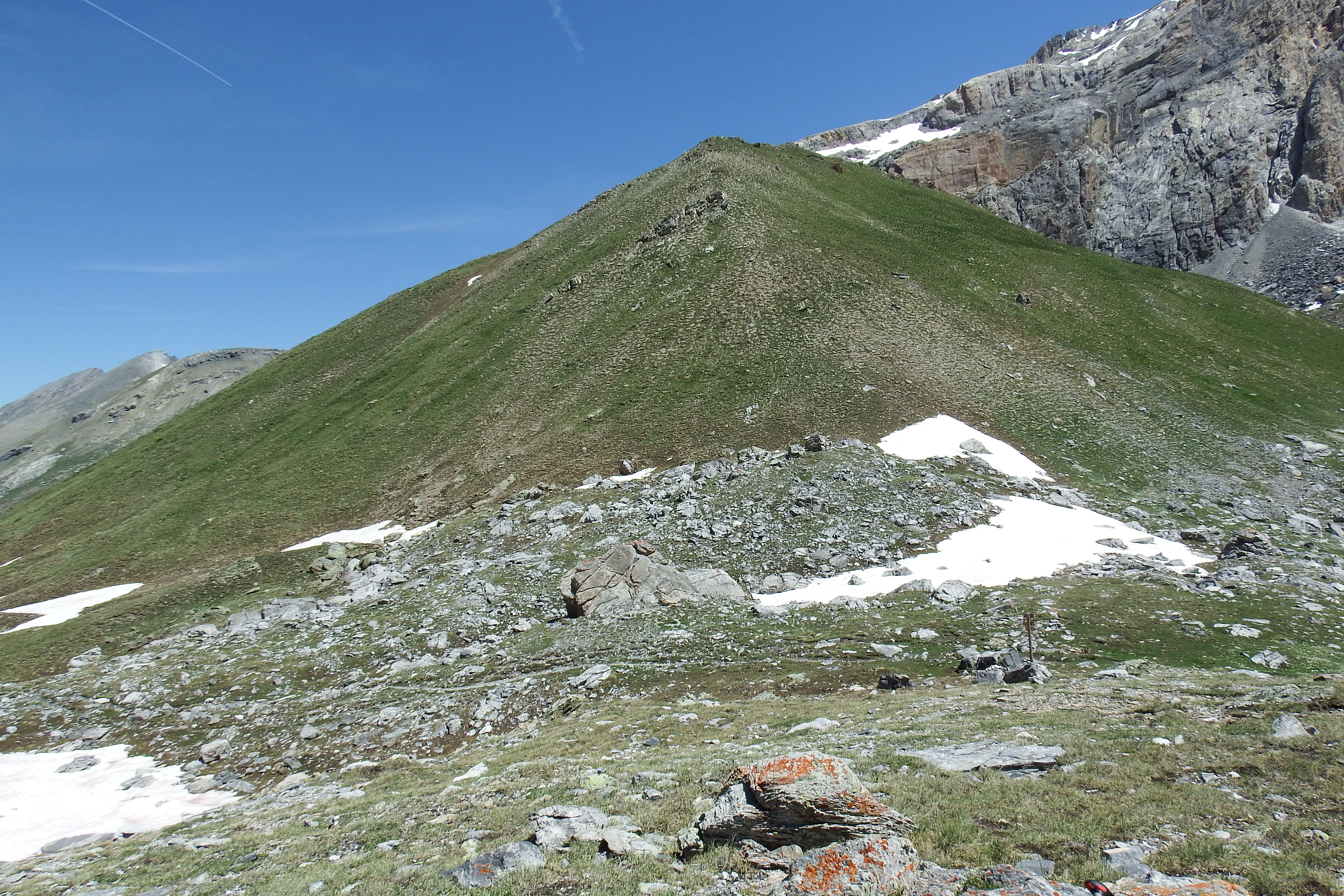
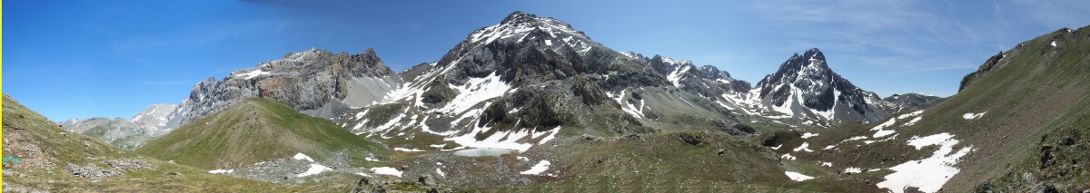
IMG_0790.JPG (2.25 MO) 2592 x 1944 Tête de Plate Lombarde que l'on contourne ... |
IMG_0791.JPG (2.94 MO) 2592 x 1944 avec un panorama qui va aller grandissant |
IMG_0792.JPG (2.74 MO) 2592 x 1944 |
IMG_0793.JPG (2.18 MO) 2592 x 1944 Rocca Blanca |
IMG_0795.JPG (2.72 MO) 2592 x 1944 et là-bas un fort que je pense sur Roir Alp ou pas loin |
IMG_0796.JPG (1.52 MO) 1944 x 2592 benoîtes des montagnes |
IMG_0797.JPG (1.95 MO) 2592 x 1944 |
IMG_0798.JPG (2.73 MO) 2592 x 1944 et le Lac du Vallonet Supérieur |
IMG_0799.JPG (2.91 MO) 2592 x 1944 on va passer aux panneaux du col et chercher à voir Viraysse ... |
|
| |
|


 _Guest book