| - Canon PS A710 (200x) | |
IMG_3599.JPG
(2.29 MO) 2592 x 1944 JP le spécialiste flore, entre autres ... |
IMG_3600.JPG
(2.1 MO) 2592 x 1944 |
IMG_3601.JPG
(1.78 MO) 2592 x 1944 Tête de la Gipière à g. au centre, et Montagnette et Pouzenc à d. ( à flanc du Pinet ) |
IMG_3602.JPG
(1.6 MO) 2592 x 1944 malgré notre doute, ce sont Louis XVI et Peissiéou à d., et le Joug de l'Aigle qui dépasse à leur g. ? |
IMG_3603.JPG
(1.38 MO) 2592 x 1944 Montagnette et Pouzenc là |
IMG_3604.JPG
(3.29 MO) 2592 x 1944 une rencontre assez rare : un orvet sur le chemin |
IMG_3605.JPG
(3.26 MO) 2592 x 1944 |
IMG_3606.JPG
(2 MO) 2592 x 1944 le troupeau en haut avec le berger à d. |
IMG_3607.JPG
(1.99 MO) 2592 x 1944 |
IMG_3608.JPG
(2.04 MO) 2592 x 1944 |
IMG_3609.JPG
(2.93 MO) 2592 x 1944 |
IMG_3610.JPG
(2.67 MO) 2592 x 1944 j'aime ce genre de "cailloux" |
IMG_3611.JPG
(2.66 MO) 2592 x 1944 |
IMG_3612.JPG
(2.49 MO) 2592 x 1944 |
IMG_3613.JPG
(2.75 MO) 2592 x 1944 |
IMG_3614.JPG
(2.77 MO) 2592 x 1944 une gentiane cillée dit JP, on en verra beaucoup |
IMG_3615.JPG
(2.07 MO) 2592 x 1944 nous allons casser la croûte au bord du torrent 2054m ( l'Essaleyret ), petit tour d'horizon |
IMG_3616.JPG
(1.95 MO) 2592 x 1944 à g. Le Pinet ( fait jadis ) et Roche Bénite au centre, qui nous cachent la Séolane des Besses et le col des Terres Blanches |
IMG_3617.JPG
(1.79 MO) 2592 x 1944 |
IMG_3618.JPG
(1.4 MO) 2592 x 1944 un bout de Séolane des Besses ? |
IMG_3619.JPG
(2.45 MO) 2592 x 1944 |
IMG_3620.JPG
(2.33 MO) 2592 x 1944 |
IMG_3621.JPG
(2.25 MO) 2592 x 1944 |
IMG_3622.JPG
(2.43 MO) 2592 x 1944 |
IMG_3623.JPG
(2.72 MO) 2592 x 1944 |
IMG_3624.JPG
(2.39 MO) 2592 x 1944 |
IMG_3625.JPG
(1.99 MO) 2592 x 1944 fin du casse-croûte --> |
IMG_3626.JPG
(1.68 MO) 2592 x 1944 on vient de refuser et contourner une montée dans des petites pierres, au retour, on verra que c'est le chemin normal, mais plus facile à descendre qu'à monter ! alors pas de regret ! |
IMG_3627.JPG
(1.57 MO) 2592 x 1944 un petit 360°, Aupillon et Balaour ( internes au Laverq ) sans doute |
IMG_3628.JPG
(1.73 MO) 2592 x 1944 |
IMG_3629.JPG
(1.88 MO) 2592 x 1944 Petite Séolane ( et son chapeau rond ) au 1/3 d. |
IMG_3630.JPG
(2.08 MO) 2592 x 1944 |
IMG_3631.JPG
(2.52 MO) 2592 x 1944 |
IMG_3632.JPG
(2.65 MO) 2592 x 1944 |
IMG_3633.JPG
(2.73 MO) 2592 x 1944 |
IMG_3634.JPG
(2.55 MO) 2592 x 1944 |
IMG_3635.JPG
(2.56 MO) 2592 x 1944 on va monter en face puis g. |
IMG_3636.JPG
(2.39 MO) 2592 x 1944 au tracé, j'avais choisi de contourner la bosse de gauche par la droite, mais, à refaire, par la gauche ce doit être agréable aussi, on y a vu quelques 7 brebis et 1 agneau au retour ( égarés ? ) |
IMG_3637.JPG
(2.59 MO) 2592 x 1944 |
IMG_3638.JPG
(2.56 MO) 2592 x 1944 |
IMG_3639.JPG
(2.49 MO) 2592 x 1944 et là, au fond, ce doit être La Mournière et Roche Close au sud du col |
IMG_3640.JPG
(2.35 MO) 2592 x 1944 |
IMG_3641.JPG
(2.41 MO) 2592 x 1944 |
IMG_3642.JPG
(2.35 MO) 2592 x 1944 |
IMG_3643.JPG
(1.67 MO) 2592 x 1944 fin du 360° |
IMG_3644.JPG
(2.72 MO) 2592 x 1944 donc on passe par la droite, on fera la sieste dans ce quartier au retour |
IMG_3645.JPG
(2.88 MO) 2592 x 1944 |
IMG_3646.JPG
(2.98 MO) 2592 x 1944 |
IMG_3647.JPG
(2.87 MO) 2592 x 1944 |
IMG_3648.JPG
(2.15 MO) 2592 x 1944 |
IMG_3649.JPG
(2.4 MO) 2592 x 1944 |
IMG_3650.JPG
(2.62 MO) 2592 x 1944 là on retrouve une trace un peu plus nette qui vient du fameux chemin signalé sur aucune carte, d'oû est arrivé un couple avec chien, des bergers ? |
IMG_3651.JPG
(2.91 MO) 2592 x 1944 aller, on va grimper ... |
IMG_3652.JPG
(3.04 MO) 2592 x 1944 on vient de contourner en montant |
IMG_3653.JPG @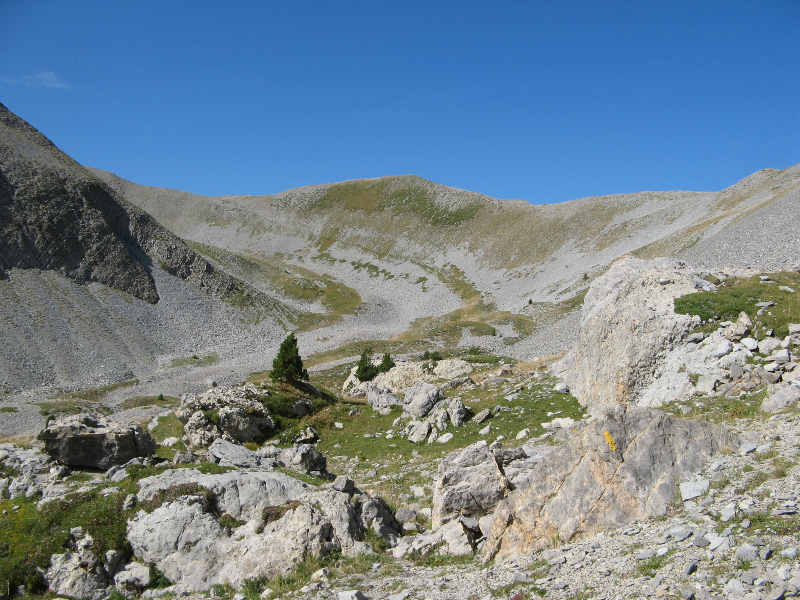
(2.71 MO) 2592 x 1944 et le col s'offre à nous en face, y'a plus qu'à ... un petit 360° avant |
IMG_3654.JPG
(2.58 MO) 2592 x 1944 plus moyen de retenir "mollet d'acier", néanmoins convalescent |
IMG_3655.JPG
(2.55 MO) 2592 x 1944 |
IMG_3656.JPG
(2.38 MO) 2592 x 1944 |
IMG_3657.JPG
(2.36 MO) 2592 x 1944 |
IMG_3658.JPG
(2.55 MO) 2592 x 1944 |
IMG_3659.JPG
(2.39 MO) 2592 x 1944 |
IMG_3660.JPG
(2.64 MO) 2592 x 1944 |
IMG_3661.JPG
(2.6 MO) 2592 x 1944 |
IMG_3662.JPG
(2.76 MO) 2592 x 1944 |
IMG_3663.JPG
(2.8 MO) 2592 x 1944 |
IMG_3664.JPG
(2.52 MO) 2592 x 1944 fin du 360° |
IMG_3665.JPG
(2.85 MO) 2592 x 1944 pour le retour si l'orage gronde ... |
IMG_3666.JPG
(2.26 MO) 2592 x 1944 |
IMG_3667.JPG
(2.03 MO) 2592 x 1944 |
IMG_3668.JPG
(1.73 MO) 2592 x 1944 la Grande Séolane au fond |
IMG_3669.JPG
(1.48 MO) 2592 x 1944 |
IMG_3670.JPG
(2.12 MO) 2592 x 1944 |
IMG_3671.JPG
(1.4 MO) 2592 x 1944 |
IMG_3672.JPG
(2.13 MO) 2592 x 1944 et la Petite |
IMG_3673.JPG
(2.95 MO) 2592 x 1944 le chemin pris jadis par le papy parapentiste ( vers Roche Close ) quand nous avions fait le col côté Seyne ( 300m de déniv. de plus ! ) |
IMG_3674.JPG
(2.54 MO) 2592 x 1944 on est attendu au col ! |
IMG_3675.JPG
(1.79 MO) 2592 x 1944 |
IMG_3676.JPG
(2 MO) 2592 x 1944 |
IMG_3677.JPG
(2.04 MO) 2592 x 1944 |
IMG_3678.JPG @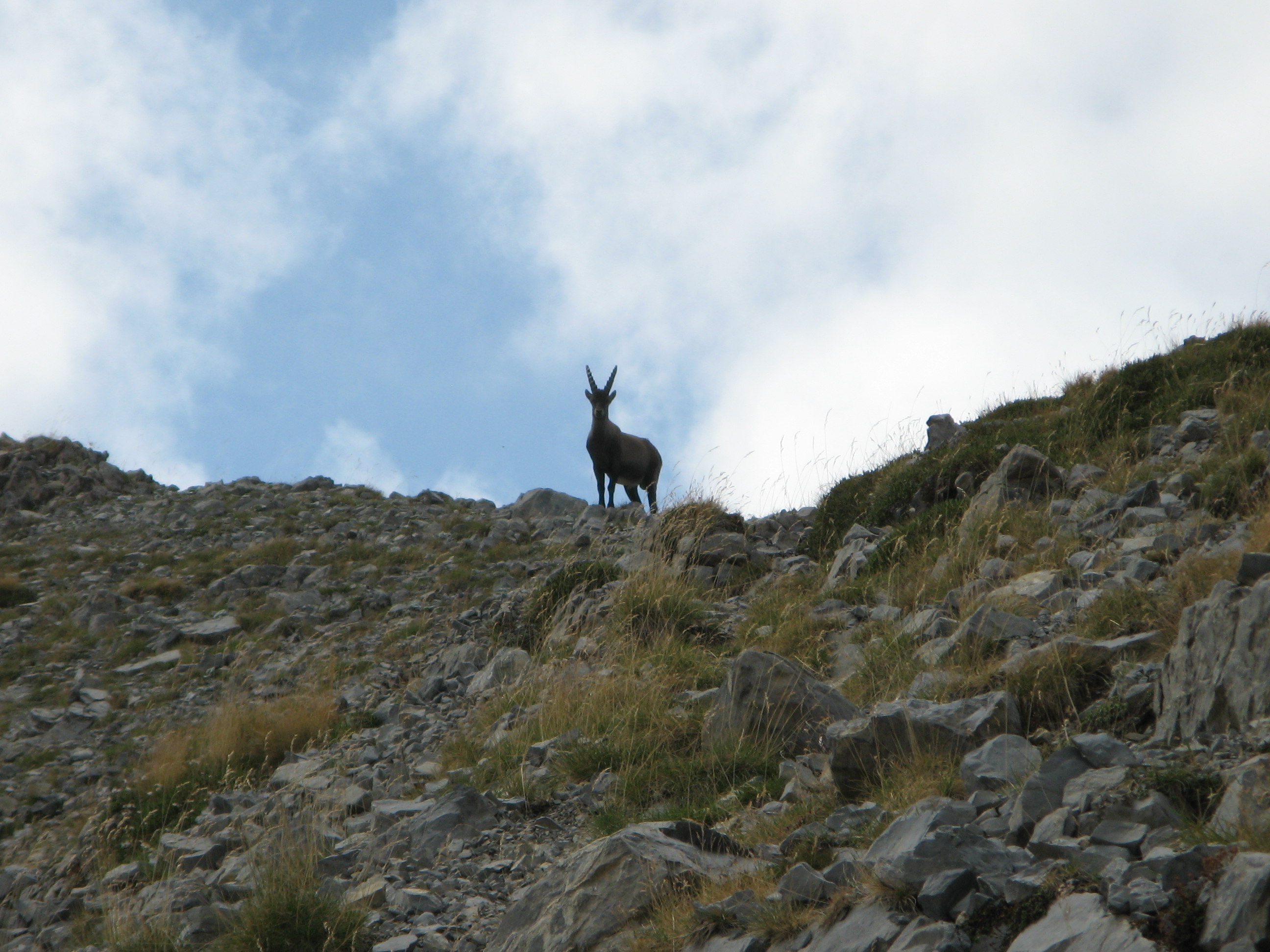
(1.96 MO) 2592 x 1944 |
IMG_3680.JPG
(1.86 MO) 2592 x 1944 quel dédain ! |
IMG_3681.JPG
(3.14 MO) 2592 x 1944 |
IMG_3682.JPG
(1.92 MO) 2592 x 1944 pas du tout ému de nous voir .... le chef sans doute ! |
IMG_3683.JPG @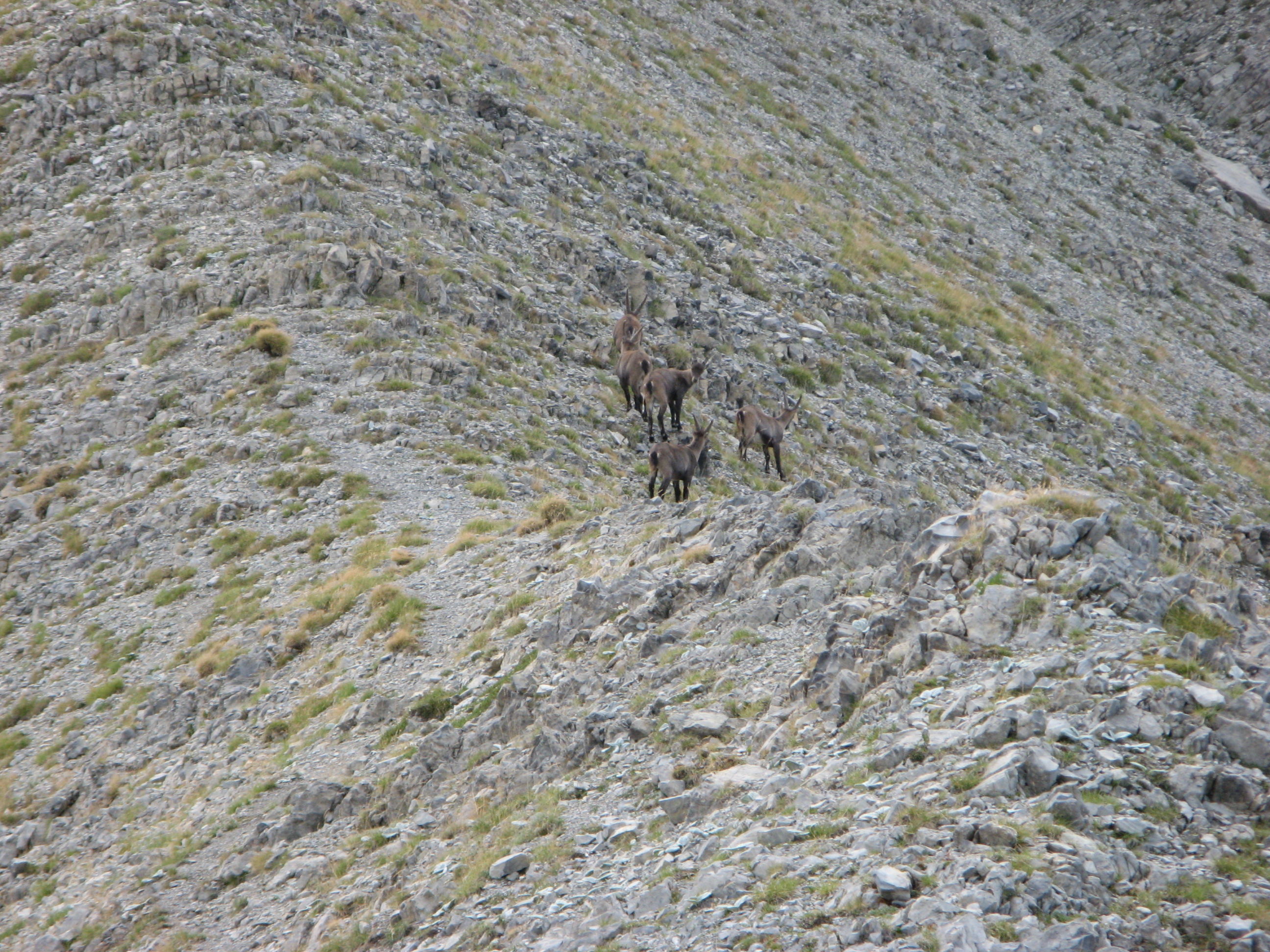
(2.91 MO) 2592 x 1944 |
IMG_3684.JPG
(3.16 MO) 2592 x 1944 |
IMG_3685.JPG
(3.19 MO) 2592 x 1944 |
IMG_3686.JPG
(1.6 MO) 2592 x 1944 le Mourre-Frey |
IMG_3687.JPG
(1.5 MO) 2592 x 1944 Carton et Cheval Blanc |
IMG_3688.JPG
(1.51 MO) 2592 x 1944 Cucuyon et Couard |
IMG_3689.JPG
(1.58 MO) 2592 x 1944 Grisonnière |
IMG_3690.JPG
(2.05 MO) 2592 x 1944 et Val Pousane et ses vaches |
IMG_3691.JPG
(1.5 MO) 2592 x 1944 |
IMG_3692.JPG
(1.67 MO) 2592 x 1944 |
IMG_3693.JPG
(2.14 MO) 2592 x 1944 le Tourtourel |
IMG_3694.JPG
(1.98 MO) 2592 x 1944 on a vu avec peine Mourre de Chanier, Chiran, Montdenier et Beynes |
IMG_3695.JPG
(1.89 MO) 2592 x 1944 le Blayeul au centre en haut |
IMG_3696.JPG
(1.9 MO) 2592 x 1944 la station du Grand Puy à droite |
IMG_3697.JPG @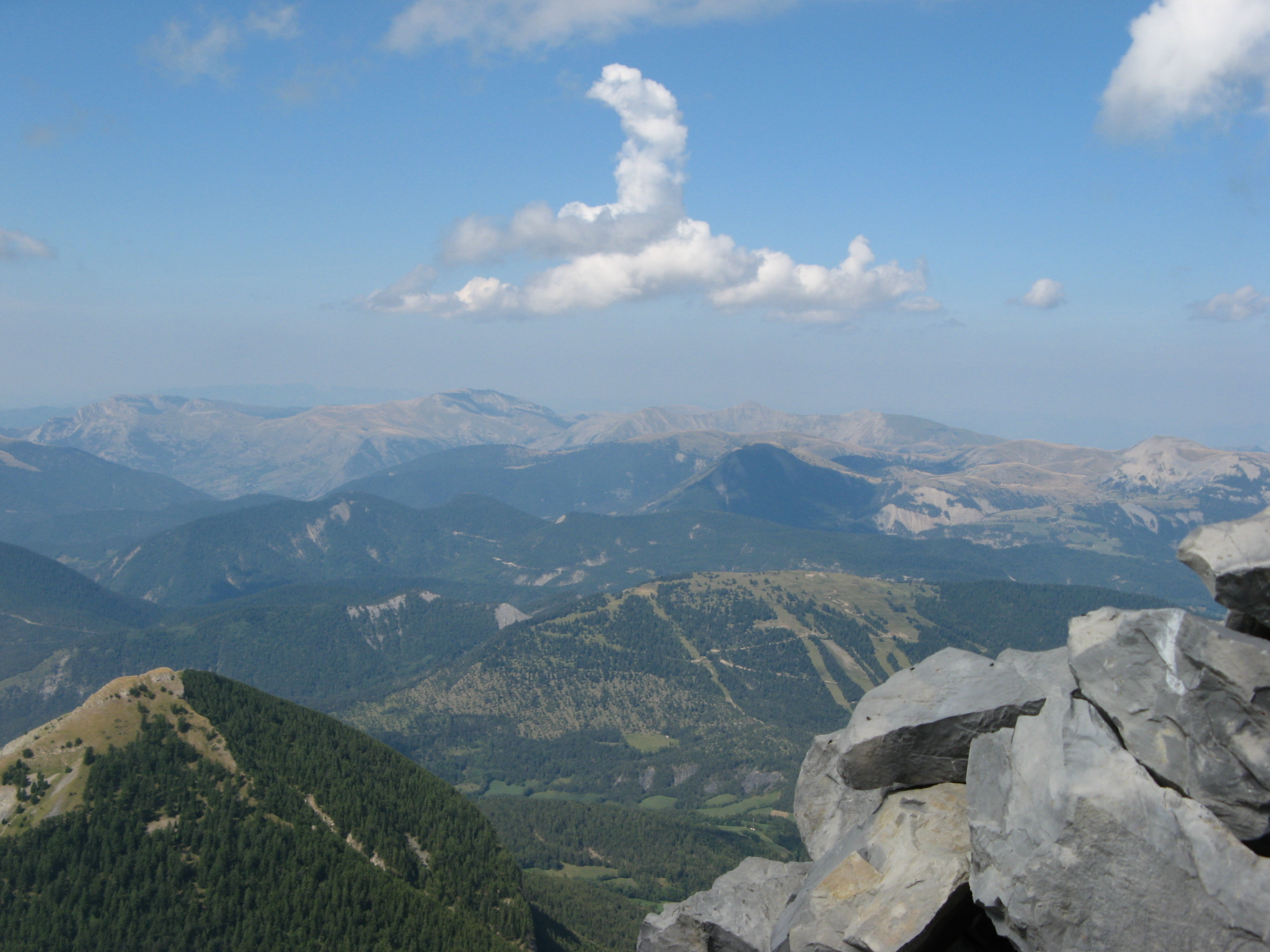
(1.71 MO) 2592 x 1944 et ici, Barles, Nibles, Monges, Laupie, Cimette, Oratoire, Tête Grosse, Marzenc, Tomples, Clot de Bouc etc |
IMG_3698.JPG
(3.11 MO) 2592 x 1944 nos voisins continueront à progresser dans les pentes en face |
IMG_3699.JPG
(3.35 MO) 2592 x 1944 la pierre sous laquelle JP avait fait la sieste l'autre fois ! faut avoir confiance ! n'est ce pas ? |
IMG_3700.JPG
(2.45 MO) 2592 x 1944 toujours des chevaux dans ce coin là |
IMG_3701.JPG
(2.37 MO) 2592 x 1944 vers la cabane des mulets et le parking de Maure ( point de départ de l'autre côté ) |
IMG_3702.JPG
(2.24 MO) 2592 x 1944 Seyne |
IMG_3703.JPG
(2.28 MO) 2592 x 1944 on va grimper à notre point de vue ( 2452m ), comme l'autre fois |
IMG_3704.JPG
(2.41 MO) 2592 x 1944 l'Aiguillette |
IMG_3705.JPG
(1.93 MO) 2592 x 1944 |
IMG_3706.JPG
(2.25 MO) 2592 x 1944 |
IMG_3707.JPG
(1.87 MO) 2592 x 1944 |
IMG_3719_belette.JPG
(2.43 MO) 2592 x 1944 voici nos compagnes de repas ( au fond ), des belettes |
IMG_3720.JPG
(1.19 MO) 2592 x 1944 mais tellement vives qu'il faut de la patience |
IMG_3721.JPG
(1.22 MO) 2592 x 1944 |
IMG_3722.JPG
(1.23 MO) 2592 x 1944 elle se cache derrière le brin d'herbe |
IMG_3723.JPG
(1013 KO) 2592 x 1944 |
IMG_3723_a.JPG @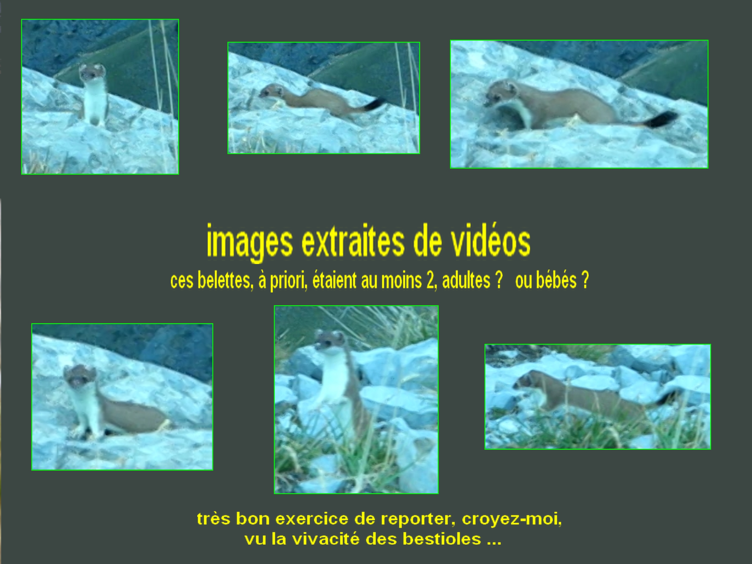
(1.11 MO) 2592 x 1944 |
IMG_3724.JPG
(2.31 MO) 2592 x 1944 JP un peu de modestie quand tu me dis : "regarde la Grande Séolane" pendant que tu te soulages |
IMG_3725.JPG
(1.84 MO) 2592 x 1944 ah là ! oui |
IMG_3726.JPG
(1.9 MO) 2592 x 1944 Neillère au centre, mais les belettes m'ont fait oublier de prendre toute la crête avec Bernardez et Dormillouse etc | notre trace @ 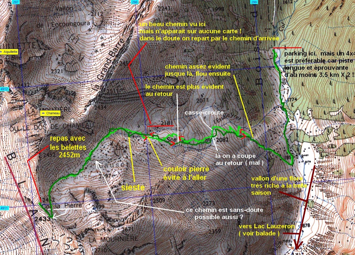 le ciel devenant un peu menaçant, nous repartons assez rapidement, pensant siester vers le haut de la bosse 2354, nous repartirons siester au-dessous car quelques gouttes nous dissuadent, ensuite pas de souci |
|
|
|
 _Guest book