| - Canon PS A710 (200x) | |
IMG_5687.JPG__08h57
(1.59 MO) 2592 x 1944 nous avons démarré à 08h35 |
IMG_5688.JPG
(1.5 MO) 2592 x 1944 |
IMG_5689.JPG
(2.18 MO) 2592 x 1944 |
IMG_5690.JPG__09h44
(1.86 MO) 2592 x 1944 le Ventoux |
IMG_5691.JPG
(2.29 MO) 2592 x 1944 Lure semi caché |
IMG_5692.JPG__11h14
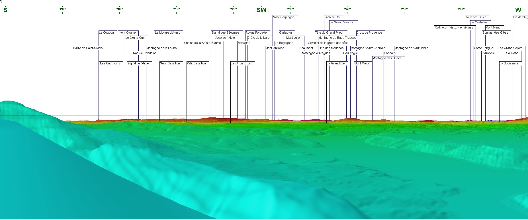
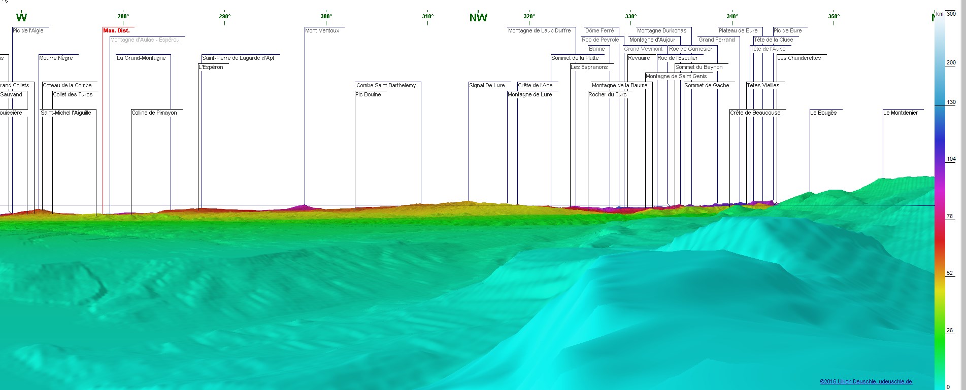
(2.42 MO) 2592 x 1944 arrivée à notre but, cairn visible à gauche Mondenier nord enneigé au centre ( #355°), pano 360 anti-horaire |
IMG_5693.JPG
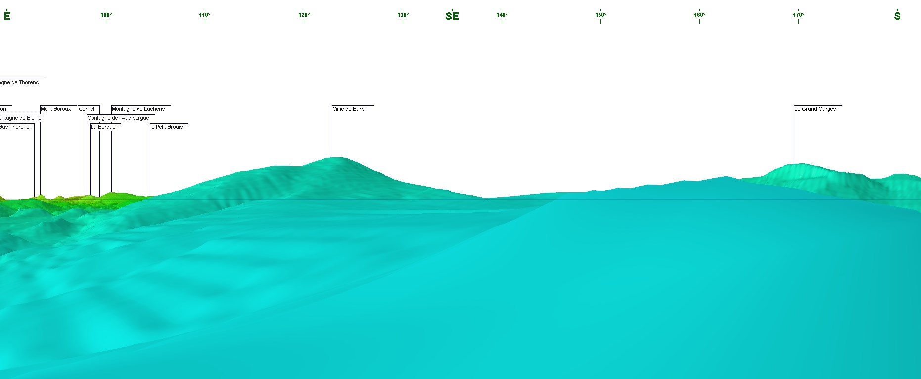
(2.37 MO) 2592 x 1944 pour bien suivre les 360° ---> Pano |
IMG_5694.JPG
(2.25 MO) 2592 x 1944 |
IMG_5695.JPG
(2.28 MO) 2592 x 1944 |
IMG_5696.JPG
(2.31 MO) 2592 x 1944 |
IMG_5697.JPG
(2.21 MO) 2592 x 1944 |
IMG_5698.JPG
(2.22 MO) 2592 x 1944 |
IMG_5699.JPG
(2.33 MO) 2592 x 1944 |
IMG_5700.JPG
(2.25 MO) 2592 x 1944 |
IMG_5701.JPG
(2.37 MO) 2592 x 1944 |
IMG_5702.JPG
(2.3 MO) 2592 x 1944 |
IMG_5703.JPG
(2.15 MO) 2592 x 1944 |
IMG_5704.JPG
(2.01 MO) 2592 x 1944 |
IMG_5705.JPG
(1.86 MO) 2592 x 1944 alors là, en face il y a la route du col d'Illoire et ce serait le petit Margès au-dessus |
IMG_5706.JPG
(2.07 MO) 2592 x 1944 le Grand Margès ( objet d'une prochaine visite ) est caché derrière ça qui semble être la borne 1257 de notre côté |
IMG_5707.JPG
(2.42 MO) 2592 x 1944 |
IMG_5708.JPG
(2.53 MO) 2592 x 1944 |
IMG_5709.JPG
(2.73 MO) 2592 x 1944 à dr. la Cime de Barbin |
IMG_5710.JPG
(2.82 MO) 2592 x 1944 |
IMG_5711.JPG
(2.65 MO) 2592 x 1944 |
IMG_5712.JPG
(2.28 MO) 2592 x 1944 |
IMG_5713.JPG
(2.33 MO) 2592 x 1944 au premier plan Montdenier et derrière les "Mourre" |
IMG_5714.JPG
(2.38 MO) 2592 x 1944 |
IMG_5715.JPG
(2.38 MO) 2592 x 1944 Chiran au centre et les 2 bosses du Pavillon à sa g. |
IMG_5716.JPG
(2.45 MO) 2592 x 1944 il est très difficile de discerner le Pavillon du Montdenier mais, à part les 2 bosses du Pavillon, le reste c'est Montdenier ( #10km !!! ) |
IMG_5717.JPG
(2.46 MO) 2592 x 1944 |
IMG_5718.JPG
(2.69 MO) 2592 x 1944 fin du premier tour non zoomé |
IMG_5719.JPG
(1.96 MO) 2592 x 1944 idem en zoomant : Gd Ferrand et Bure |
IMG_5720.JPG
(1.9 MO) 2592 x 1944 puis Ormans, Garnesier et Vachères |
IMG_5721.JPG
(1.91 MO) 2592 x 1944 |
IMG_5722.JPG
(1.74 MO) 2592 x 1944 |
IMG_5723.JPG @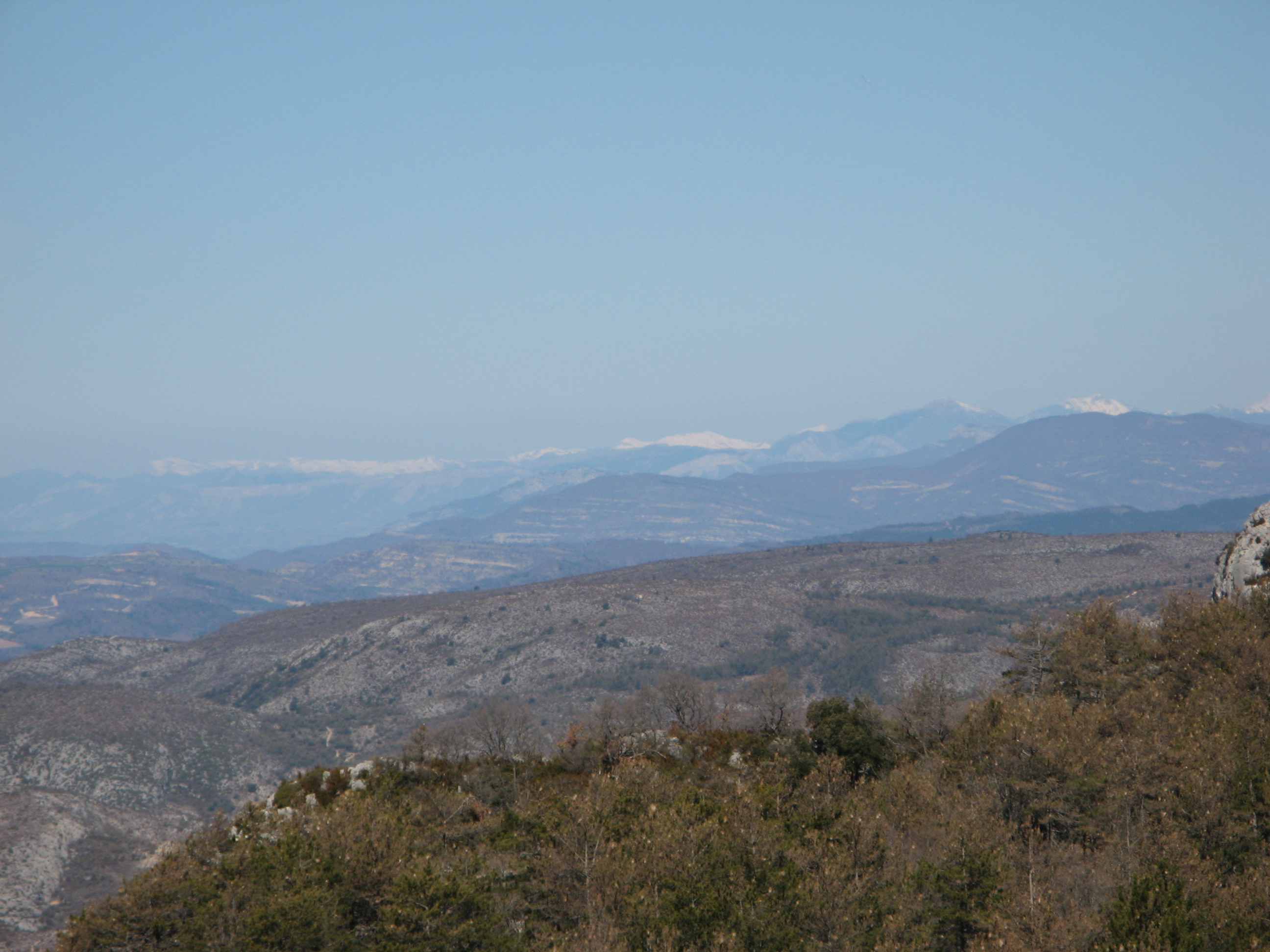
(1.73 MO) 2592 x 1944 les crêtes de Luzet à g. puis Toussière sans doute et Aujour ( avec un bout du Gd Veymont ) et Durbonas |
IMG_5724.JPG @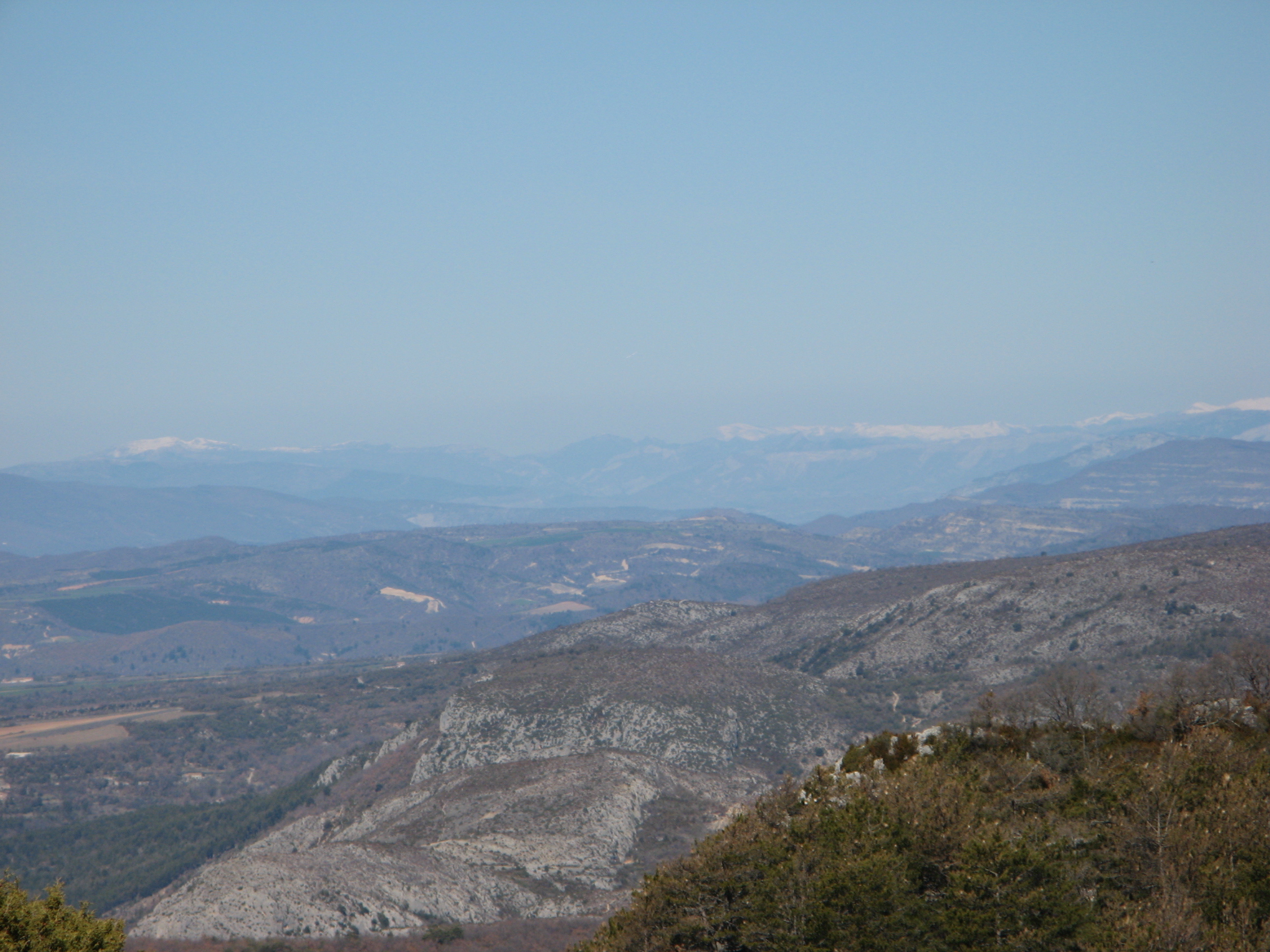
(1.67 MO) 2592 x 1944 |
IMG_5725.JPG @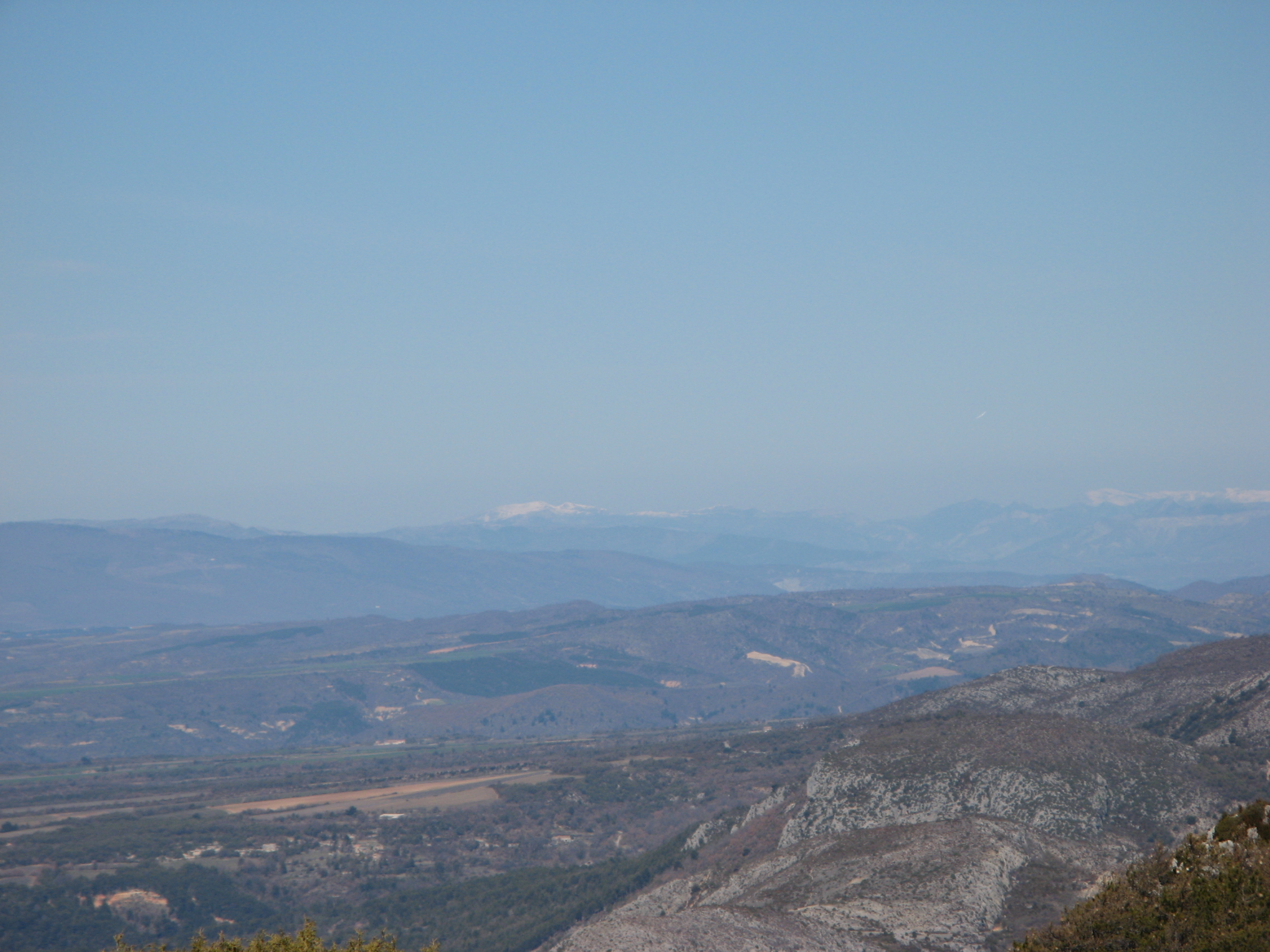
(1.53 MO) 2592 x 1944 le Duffre au fond |
IMG_5726.JPG
(1.64 MO) 2592 x 1944 |
IMG_5727.JPG
(1.51 MO) 2592 x 1944 Lure |
IMG_5728.JPG
(1.48 MO) 2592 x 1944 |
IMG_5729.JPG
(1.58 MO) 2592 x 1944 le Ventoux s'est emmitouflé |
IMG_5730.JPG
(1.53 MO) 2592 x 1944 |
IMG_5731.JPG
(1.5 MO) 2592 x 1944 Manosque et le Lubéron avec le Mourre Nègre |
IMG_5732.JPG
(1.54 MO) 2592 x 1944 centre de radio diffusion - à Roumoules |
IMG_5733.JPG
(1.49 MO) 2592 x 1944 |
IMG_5734.JPG
(1.42 MO) 2592 x 1944 la Ste Victoire avec le Pic des Mouches à g. |
IMG_5735.JPG
(1.4 MO) 2592 x 1944 à g. montagne du Bau Trauqua et la Tête du Grand Puech ( 779 ) |
IMG_5736.JPG
(1.45 MO) 2592 x 1944 |
IMG_5737.JPG
(1.45 MO) 2592 x 1944 peut-être le Mont Aurélien ? |
IMG_5738.JPG
(1.37 MO) 2592 x 1944 et la Ste Beaume au fond mais Bertagne vu n'est pas là ! |
IMG_5739.JPG
(1.5 MO) 2592 x 1944 |
IMG_5740.JPG
(1.52 MO) 2592 x 1944 |
IMG_5741.JPG
(1.45 MO) 2592 x 1944 là on ne connait pas assez ...... mais c'est Lachens avec les pylones |
IMG_5742.JPG
(1.55 MO) 2592 x 1944 à g. ce serait le Mont Bauroux ( et non Boroux ) |
IMG_5743.JPG
(1.5 MO) 2592 x 1944 |
IMG_5744.JPG
(1.65 MO) 2592 x 1944 au centre, la Montagne de Bleine avec le Bausson |
IMG_5745.JPG
(1.73 MO) 2592 x 1944 les Réglés ? Robion caché derrière |
IMG_5746.JPG
(1.93 MO) 2592 x 1944 |
IMG_5747.JPG
(1.96 MO) 2592 x 1944 |
IMG_5748.JPG
(1.97 MO) 2592 x 1944 et le Pioulet derrière la Crête des traversières |
IMG_5749.JPG
(1.91 MO) 2592 x 1944 |
IMG_5750.JPG
(1.96 MO) 2592 x 1944 |
IMG_5751.JPG
(2 MO) 2592 x 1944 |
IMG_5752.JPG
(1.88 MO) 2592 x 1944 le Mourre de Chanier et devant vers nous la Gondole |
IMG_5753.JPG
(1.86 MO) 2592 x 1944 |
IMG_5754.JPG
(1.86 MO) 2592 x 1944 |
IMG_5755.JPG
(1.78 MO) 2592 x 1944 |
IMG_5756.JPG
(1.76 MO) 2592 x 1944 le Grand Mourre |
IMG_5757.JPG
(1.71 MO) 2592 x 1944 |
IMG_5758.JPG
(1.77 MO) 2592 x 1944 et le Chiran |
IMG_5759.JPG @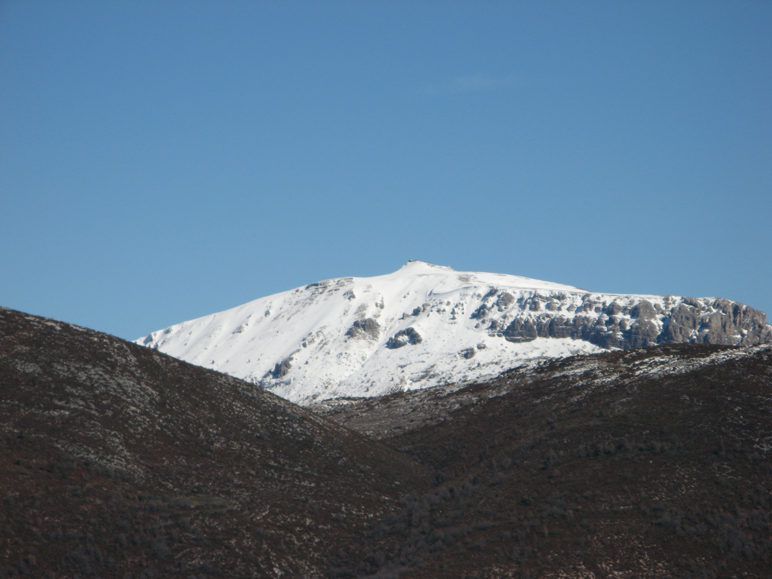
(1.7 MO) 2592 x 1944 |
IMG_5760.JPG
(1.89 MO) 2592 x 1944 |
IMG_5761.JPG
(1.81 MO) 2592 x 1944 le Pavillon |
IMG_5762.JPG
(1.75 MO) 2592 x 1944 |
IMG_5763.JPG
(1.85 MO) 2592 x 1944 |
IMG_5764.JPG
(1.66 MO) 2592 x 1944 |
IMG_5765.JPG
(1.72 MO) 2592 x 1944 extrémité nord du Montdenier |
IMG_5766.JPG
(1.62 MO) 2592 x 1944 et la guérite guet feu ( centre g. ) au Bougès |
IMG_5767.JPG
(2.02 MO) 2592 x 1944 |
IMG_5768.JPG
(2.47 MO) 2592 x 1944 le Verdon, en bas |
IMG_5769.JPG
(2.47 MO) 2592 x 1944 |
IMG_5770.JPG
(3 MO) 2592 x 1944 et la route D952 ( La Palud ) vers nous |
IMG_5771.JPG
(2.91 MO) 2592 x 1944 |
IMG_5772.JPG
(2.08 MO) 2592 x 1944 le pont du Galetas et le mélange des eaux |
IMG_5773.JPG
(2.11 MO) 2592 x 1944 |
IMG_5774.JPG
(1.75 MO) 2592 x 1944 les Salles sur Verdon |
IMG_5775.JPG
(1.81 MO) 2592 x 1944 |
IMG_5776.JPG
(1.52 MO) 2592 x 1944 |
IMG_5777.JPG
(1.52 MO) 2592 x 1944 |
IMG_5778.JPG
(1.5 MO) 2592 x 1944 |
IMG_5779.JPG
(1.85 MO) 2592 x 1944 |
IMG_5780.JPG
(1.46 MO) 2592 x 1944 |
IMG_5781.JPG
(2.15 MO) 2592 x 1944 |
IMG_5782.JPG
(1.67 MO) 2592 x 1944 |
IMG_5783.JPG
(1.5 MO) 2592 x 1944 Ste Croix de Verdon ( et son terrain de boules ... ) nous allons nous restaurer et siester |
IMG_5784.JPG__12h41
(1.73 MO) 2592 x 1944 repas pris et photos avant sieste |
IMG_5785.JPG
(1.8 MO) 2592 x 1944 |
IMG_5786.JPG
(1.85 MO) 2592 x 1944 |
IMG_5787.JPG
(2.16 MO) 2592 x 1944 |
IMG_5788.JPG
(2.42 MO) 2592 x 1944 |
IMG_5789.JPG
(2.2 MO) 2592 x 1944 |
IMG_5790.JPG
(1.9 MO) 2592 x 1944 |
IMG_5791.JPG
(1.71 MO) 2592 x 1944 |
IMG_5792.JPG @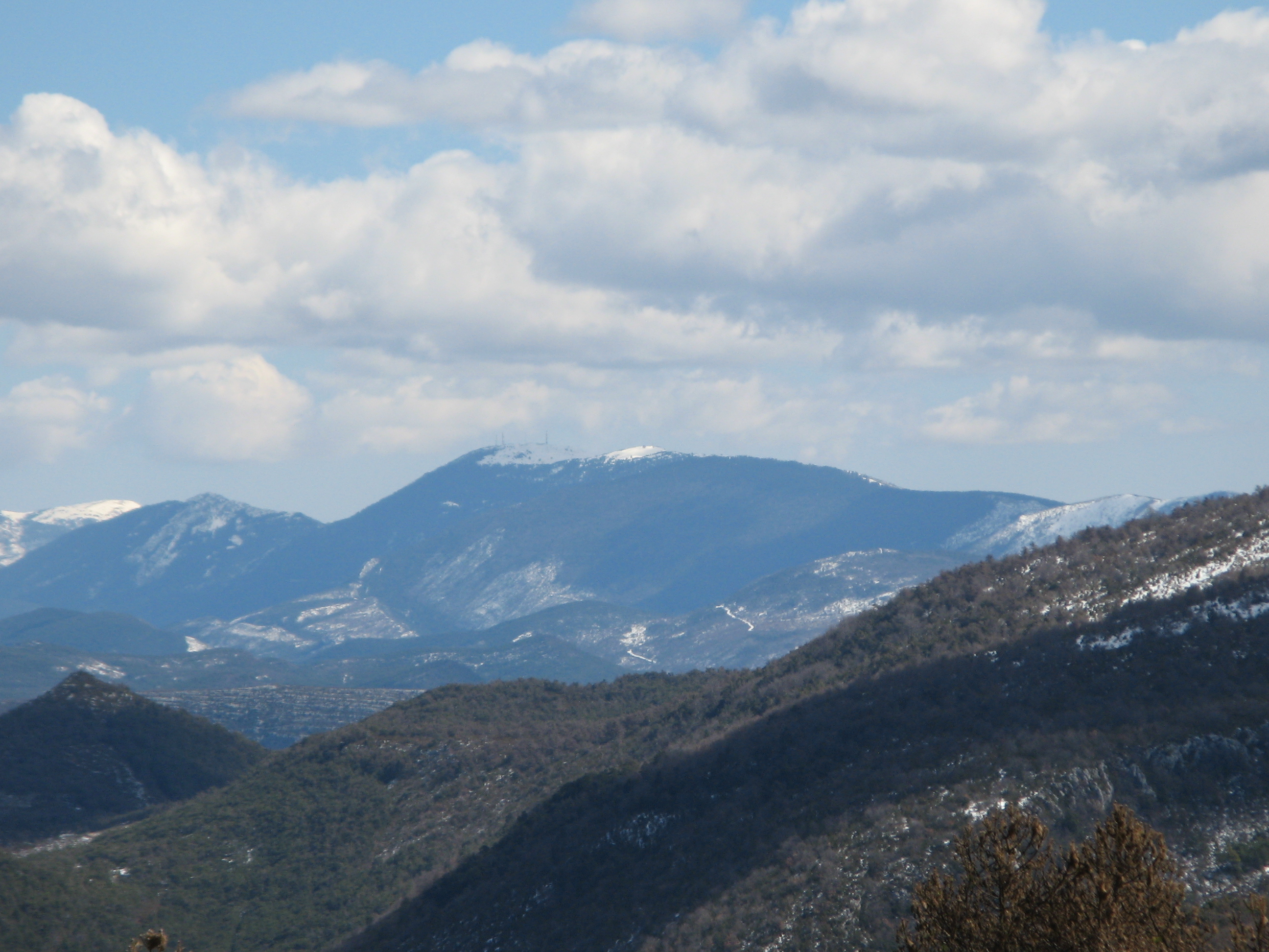
(1.71 MO) 2592 x 1944 au centre Lachens mais caché en partie droite par le Gd Brouis |
IMG_5793.JPG
(1.09 MO) 2592 x 1944 une bien belle propriété ! Château de Chanteraine à Aiguines ( centre équestre ) ? |
IMG_5794.JPG
(2.1 MO) 2592 x 1944 Bertagne au fond ? mais avec cette brume ... |
IMG_5795.JPG
(2.05 MO) 2592 x 1944 |
IMG_5796.JPG
(2.22 MO) 2592 x 1944 |
IMG_5797.JPG
(2.37 MO) 2592 x 1944 |
IMG_5798.JPG
(1.64 MO) 2592 x 1944 |
IMG_5799.JPG
(1.79 MO) 2592 x 1944 |
IMG_5800.JPG
(921 KO) 2592 x 1944 Ormans et Tête et Roc de Guarnesier |
IMG_5801.JPG
(1.05 MO) 2592 x 1944 Vachères à g. , Grand Ferrand à dr. |
IMG_5802.JPG
(886 KO) 2592 x 1944 Bure |
IMG_5803.JPG__14h59
(2.53 MO) 2592 x 1944 pendant la descente......... |
IMG_5804.JPG
(2.22 MO) 2592 x 1944 le lac étincelait |
IMG_5805.JPG
(2.23 MO) 2592 x 1944 |
IMG_5806.JPG
(2.02 MO) 2592 x 1944 sauf erreur, le pylone de droite est à l'endroit nommé "plein voir" |
IMG_5807.JPG @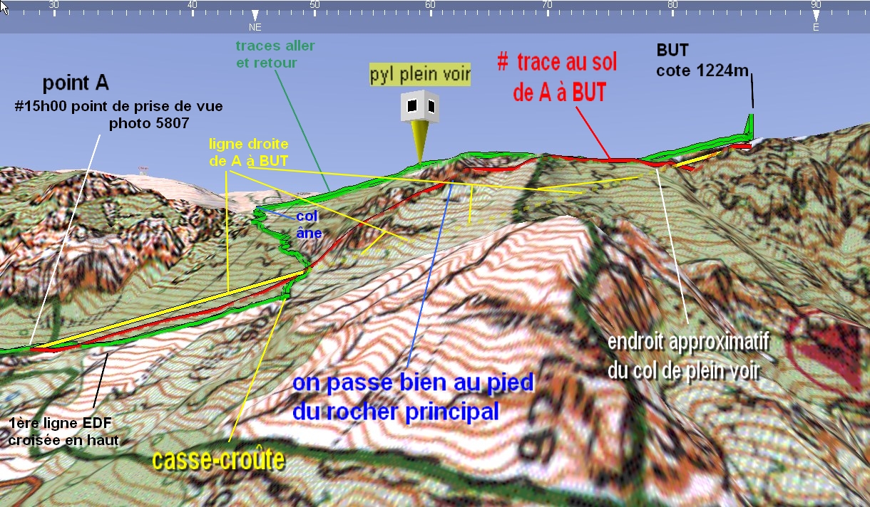
(1.94 MO) 2592 x 1944 et nous, nous étions en direction du pied du rocher principal de "plein voir" mais bien en recul derrière, cliquer pour la preuve |
IMG_5808.JPG
(2.2 MO) 2592 x 1944 |
IMG_5809.JPG
(2.01 MO) 2592 x 1944 à d. la cote 948 des Hts Vernis allant vers les Margès les 2 Margès sont bien cachés derrière |
IMG_5810.JPG
(2.01 MO) 2592 x 1944 |
IMG_5811.JPG__15h12
(3.61 MO) 2592 x 1944 grosse blague de mon "estafette" |
IMG_5812.JPG
(3.26 MO) 2592 x 1944 c'est un as des cairns mais, pour celui-là, je ne lui mets pas la moyenne |
trace @ 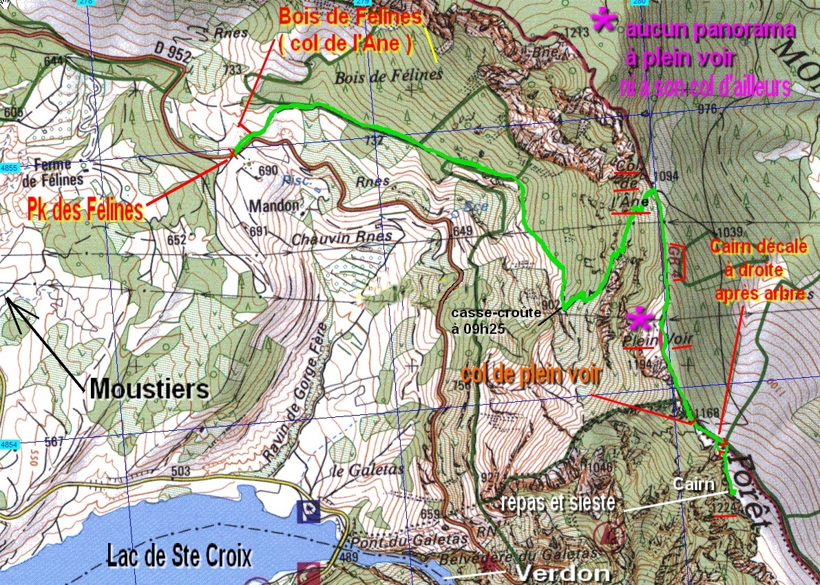
(617 KO) 1191 x 850 | retour au parking à 15h25 **** aucune difficulté, chemin évident très agréable malgré les pierres ( on a vu pire !) on est allé à la cote 1224 car aucun beau #360° avant |
|
|
|
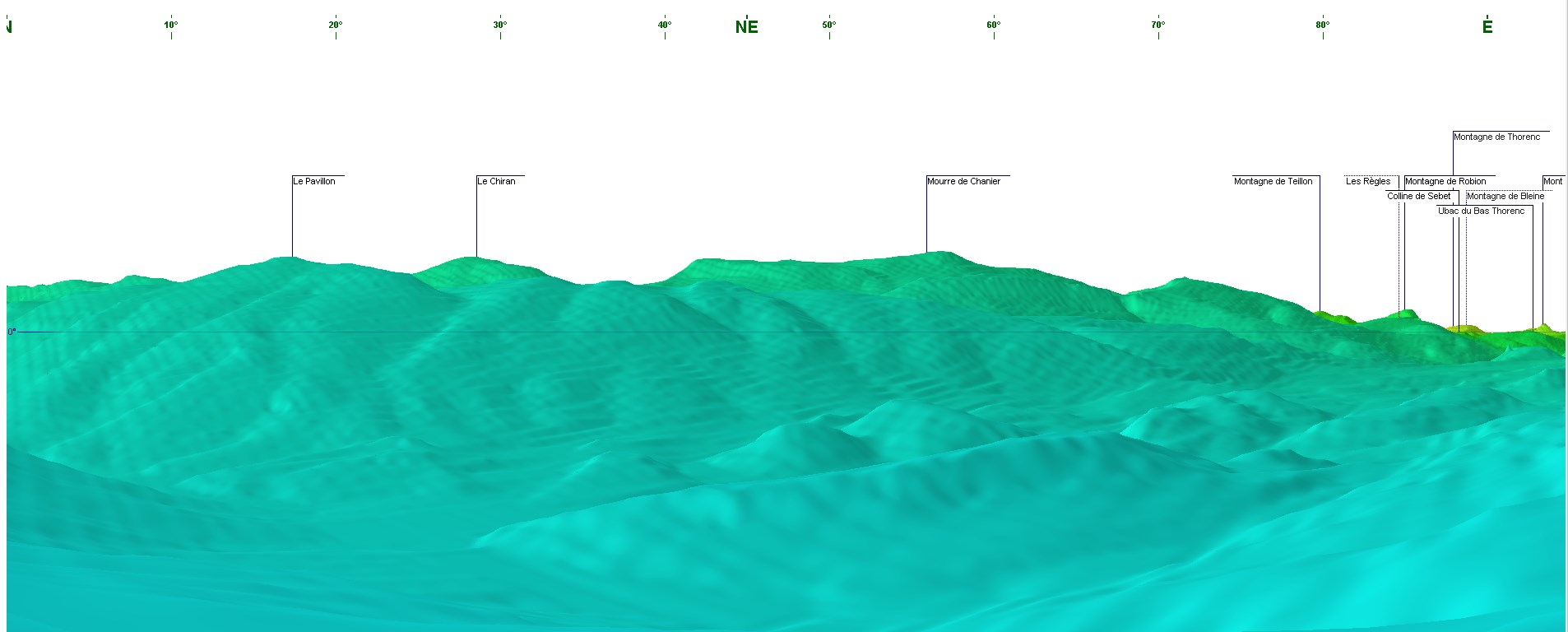
 pour visionner dans de bonnes conditions ---->

 _Guest book