| - Canon PS A710 (200x) | |
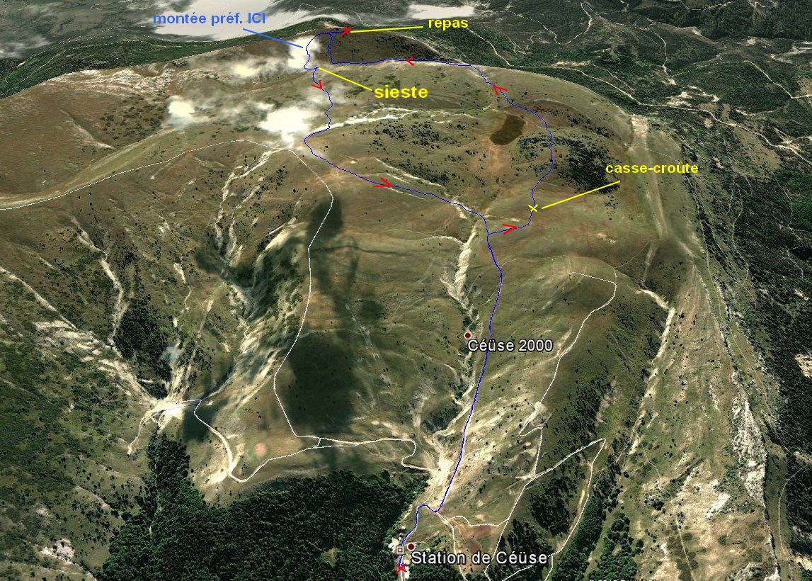
trace Google Earth à d. , cliquer dessus trace IGN à la fin |
@  |
IMG_6228.JPG - 09h12
(2.3 MO) 2592 x 1944 démarrage à 08h35, premier pano et interrogations derrière Rabou |
IMG_6229.JPG
(2.4 MO) 2592 x 1944 |
IMG_6230.JPG
(2.39 MO) 2592 x 1944 |
IMG_6231.JPG
(2.49 MO) 2592 x 1944 |
IMG_6232.JPG
(2.04 MO) 2592 x 1944 |
IMG_6233.JPG
(2.17 MO) 2592 x 1944 |
IMG_6234.JPG
(1.74 MO) 2592 x 1944 en zoomant un peu... |
IMG_6235.JPG
(1.57 MO) 2592 x 1944 |
IMG_6236.JPG
(1.63 MO) 2592 x 1944 |
IMG_6237.JPG
(1.59 MO) 2592 x 1944 |
IMG_6238.JPG @
(1.53 MO) 2592 x 1944 les questions : Le Puy au 2ème plan droit, le Pic Melette derrière à gauche, Pics de Courmiant et Montclair (arrondi) à droite |
IMG_6239.JPG @
(1.46 MO) 2592 x 1944 Pic de Gleize au centre droit ( dans l'ombre ) |
IMG_6240.JPG
(1.39 MO) 2592 x 1944 |
IMG_6241.JPG
(1.39 MO) 2592 x 1944 |
IMG_6242.JPG - 10h27 @ 360°
(2.59 MO) 2592 x 1944 on vient de reprendre le PR ? ( pointillé rouge sur carte ) on vient de couper le déversoir des marais |
IMG_6243.JPG
(1.69 MO) 2592 x 1944 le Gd Ferrand derrière le pylone ( 1805m ) |
IMG_6244.JPG
(2.44 MO) 2592 x 1944 |
IMG_6245.JPG
(2.32 MO) 2592 x 1944 |
IMG_6246.JPG
(2.27 MO) 2592 x 1944 |
IMG_6247.JPG
(2.34 MO) 2592 x 1944 |
IMG_6248.JPG
(2.26 MO) 2592 x 1944 |
IMG_6249.JPG
(2.28 MO) 2592 x 1944 |
IMG_6250.JPG
(2.02 MO) 2592 x 1944 |
IMG_6251.JPG
(2.12 MO) 2592 x 1944 |
IMG_6253.JPG
(1.77 MO) 2592 x 1944 |
IMG_6254.JPG
(1.71 MO) 2592 x 1944 elle est belle la Céüsette vue d'ici, Gâche derrière |
|
IMG_6255.JPG 
(1.71 MO) 2592 x 1944 alors là ce sommet inconnu au centre : La Plane 1576m Nez de Beaumont derrière à g. ............ Arambre à d. |
IMG_6256.JPG - 11h32 @ 360°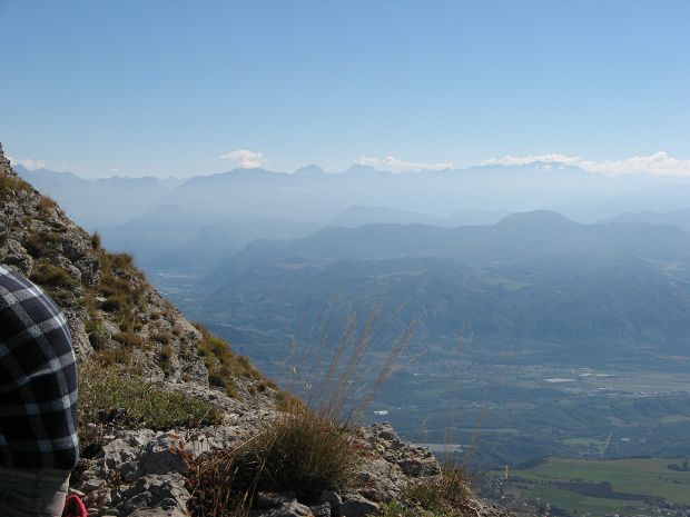
(1.79 MO) 2592 x 1944 on est au sommet Les Sciés, Dormillouse et les Séolanes à l'horizon |
IMG_6257.JPG
(1.61 MO) 2592 x 1944 |
IMG_6258.JPG
(1.54 MO) 2592 x 1944 |
IMG_6259.JPG
(1.45 MO) 2592 x 1944 |
IMG_6260.JPG
(1.48 MO) 2592 x 1944 |
IMG_6261.JPG
(1.59 MO) 2592 x 1944 |
IMG_6262.JPG
(1.67 MO) 2592 x 1944 |
IMG_6263.JPG
(1.82 MO) 2592 x 1944 |
IMG_6264.JPG
(1.81 MO) 2592 x 1944 |
IMG_6265.JPG
(1.87 MO) 2592 x 1944 à g. la Montagne de Rochefort avec l'Aiglon et La Croix, Aujour derrière ( Cécile nommé par nous, à d. 1621m ) |
IMG_6266.JPG
(2.04 MO) 2592 x 1944 on devine le Mont Ventoux à droite d'Aujour, derrière Beaumont et Arsuc, voir le 360° à la 6256 |
IMG_6267.JPG
(2.07 MO) 2592 x 1944 |
IMG_6268.JPG
(2.27 MO) 2592 x 1944 |
IMG_6269.JPG
(2.07 MO) 2592 x 1944 montagne d'Oule au centre g. arrière, crête de la Brunelle à d., à un moment donné on a aperçu les Trois Becs et le Gd Delmas |
IMG_6270.JPG
(1.91 MO) 2592 x 1944 |
IMG_6271.JPG
(1.9 MO) 2592 x 1944 Glandasse et Toussière, à g. de Durbonas |
IMG_6272.JPG
(2.05 MO) 2592 x 1944 et Charajailles au pied d. de Durbonas |
IMG_6273.JPG
(2.17 MO) 2592 x 1944 Tête et Roc de Garnesier et Tête de Vachères ( bien rectangulaire ) |
IMG_6274.JPG
(2 MO) 2592 x 1944 Le Gd Ferrand ( comme Bure ) a un voile devant lui |
IMG_6275.JPG
(2.09 MO) 2592 x 1944 |
IMG_6276.JPG
(2.01 MO) 2592 x 1944 |
IMG_6277.JPG
(2.07 MO) 2592 x 1944 pour les sommets, voir le 360° à la 6256 |
IMG_6278.JPG
(1.95 MO) 2592 x 1944 |
IMG_6279.JPG
(2.17 MO) 2592 x 1944 |
IMG_6280.JPG
(2.39 MO) 2592 x 1944 |
IMG_6281.JPG
(2.46 MO) 2592 x 1944 on a aperçu 3 ou 4 personnes sur ces bosses |
IMG_6282.JPG
(2.59 MO) 2592 x 1944 |
IMG_6283.JPG
(3.13 MO) 2592 x 1944 vers la via ferrata |
IMG_6284.JPG
(2.87 MO) 2592 x 1944 |
IMG_6285.JPG
(2.57 MO) 2592 x 1944 .......godet prêt........ pastis arrive......stop |
IMG_6286.JPG
(1.74 MO) 2592 x 1944 |
IMG_6287.JPG
(1.9 MO) 2592 x 1944 à nouveau le Pic Melette, centre d. |
IMG_6288.JPG
(1.67 MO) 2592 x 1944 Pic de Bure bouché |
IMG_6289.JPG
(1.81 MO) 2592 x 1944 Tête d'Aurouze idem |
IMG_6290.JPG
(1.83 MO) 2592 x 1944 |
IMG_6291.JPG
(2.05 MO) 2592 x 1944 |
IMG_6292.JPG
(1.83 MO) 2592 x 1944 |
IMG_6293.JPG
(1.72 MO) 2592 x 1944 |
IMG_6294.JPG
(1.7 MO) 2592 x 1944 |
IMG_6295.JPG
(2.81 MO) 2592 x 1944 |
IMG_6296.JPG
(2.91 MO) 2592 x 1944 |
IMG_6297.JPG @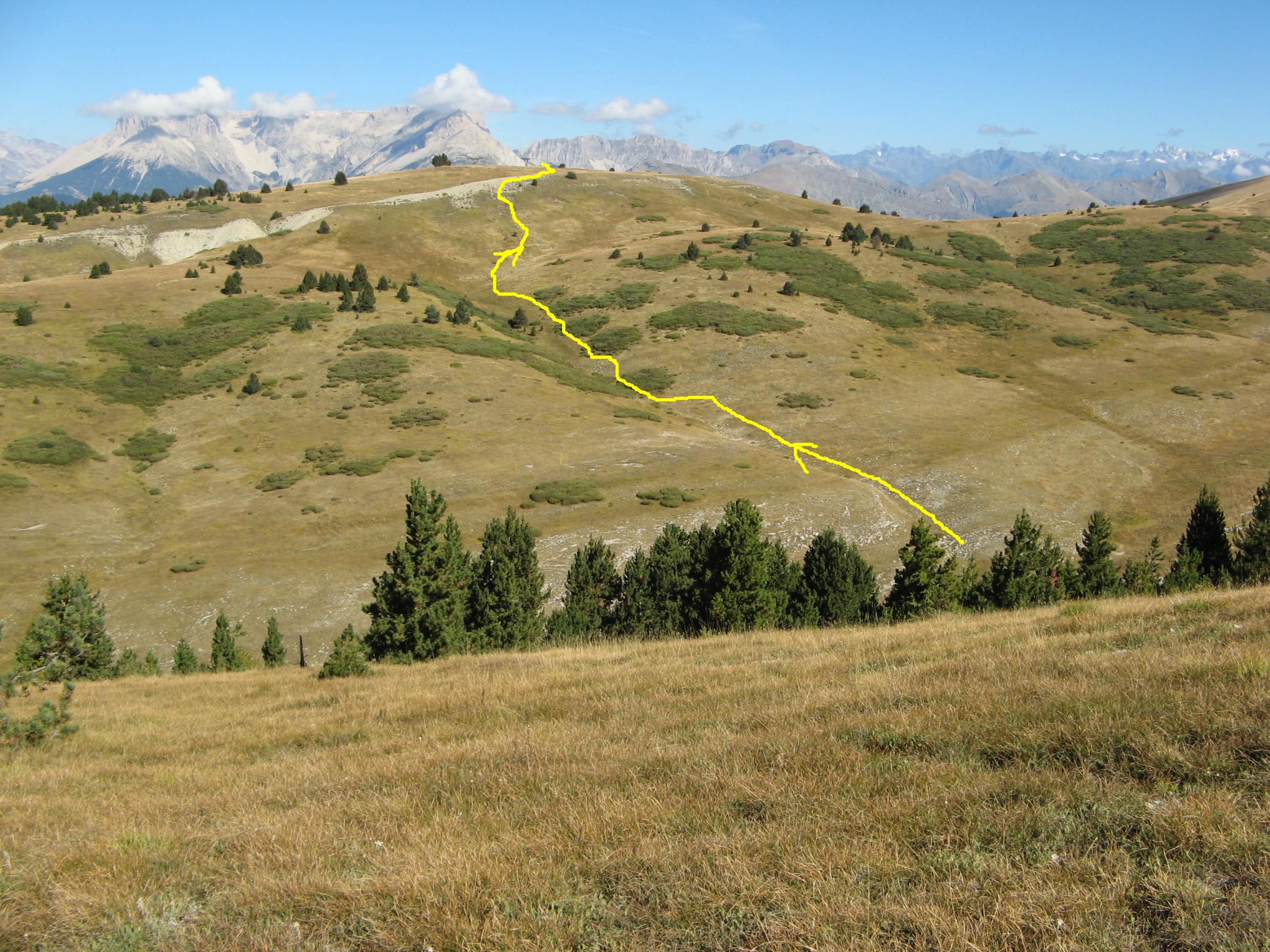
(2.78 MO) 2592 x 1944 pour repartir, nous allons prendre le sillon au centre, après une petite sieste sur le chemin, en bas |
IMG_6298.JPG 
(2.85 MO) 2592 x 1944 |
IMG_6299.JPG
(2.83 MO) 2592 x 1944 |
IMG_6300.JPG
(2.78 MO) 2592 x 1944 |
IMG_6301.JPG 
(2.91 MO) 2592 x 1944 on voit un peu le marais en haut à d. ( marron ) |
IMG_6302.JPG - 14h06 @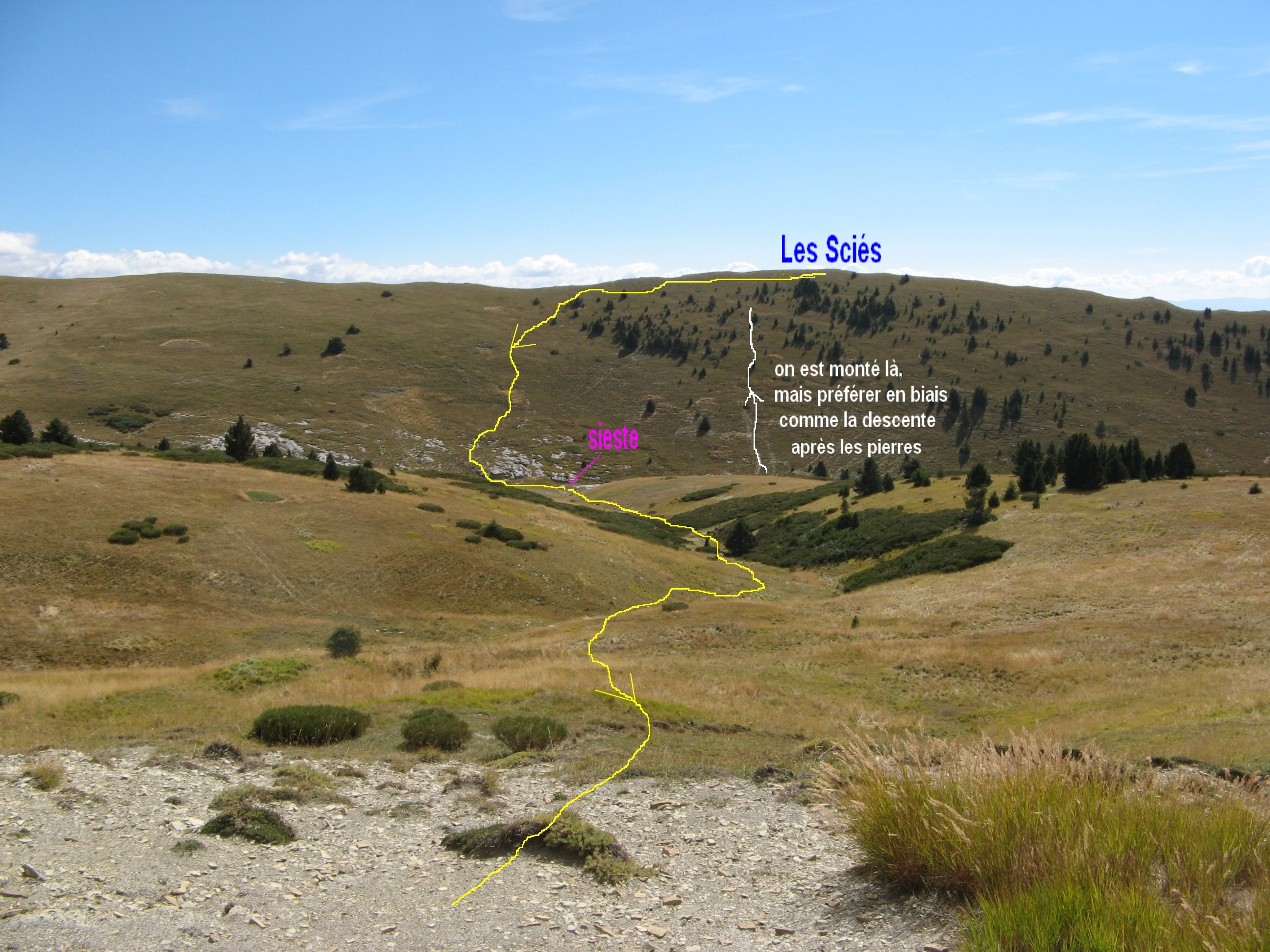
(2.28 MO) 2592 x 1944 cliquer pour voir notre chemin |
IMG_6303.JPG
(2.42 MO) 2592 x 1944 |
IMG_6304.JPG
(2.4 MO) 2592 x 1944 la via ferrata dans ce coin |
IMG_6305.JPG
(2.27 MO) 2592 x 1944 |
IMG_6306.JPG
(2.18 MO) 2592 x 1944 |
IMG_6307.JPG
(2.18 MO) 2592 x 1944 |
IMG_6308.JPG
(2.19 MO) 2592 x 1944 |
IMG_6309.JPG
(2.26 MO) 2592 x 1944 |
IMG_6310.JPG
(2.23 MO) 2592 x 1944 |
IMG_6311.JPG
(2.42 MO) 2592 x 1944 |
IMG_6312.JPG
(2.29 MO) 2592 x 1944 |
IMG_6313.JPG
(2.44 MO) 2592 x 1944 on rejoint les remontées à gauche |
IMG_6314.JPG
(2.57 MO) 2592 x 1944 |
IMG_6315.JPG - 14h25
(2.45 MO) 2592 x 1944 puis on redescend en longeant le téléski d'Aiguebelle ... |
IMG_6316.JPG
(2.43 MO) 2592 x 1944 |
IMG_6317.JPG 
(2.27 MO) 2592 x 1944 |
IMG_6318.JPG @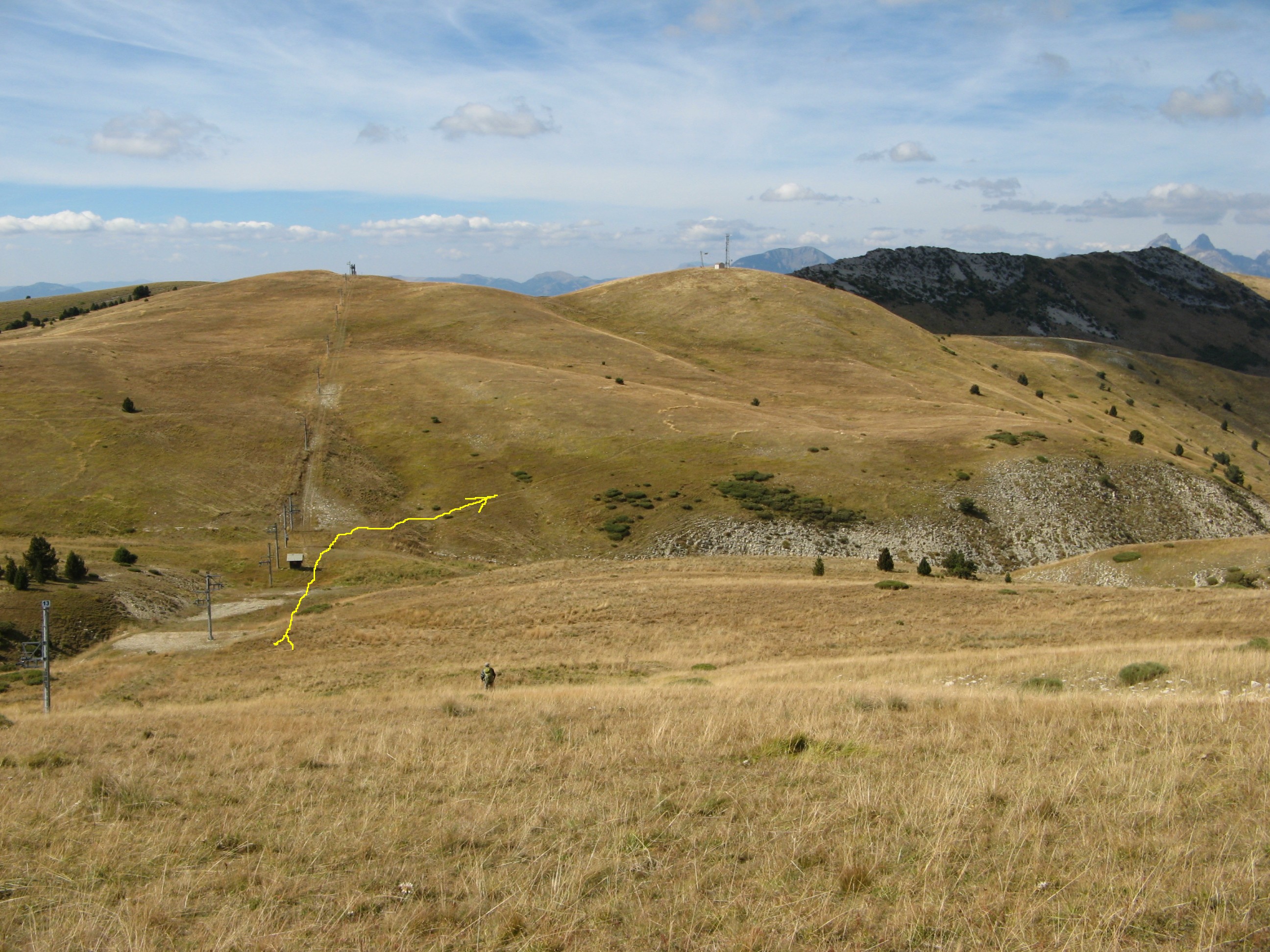
(2.34 MO) 2592 x 1944 ...pour reprendre notre chemin aller, en face |
trace.jpg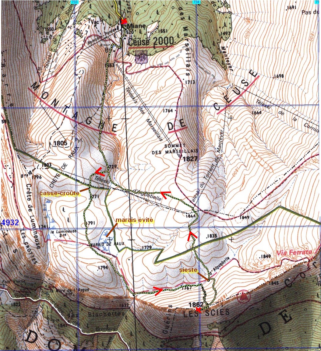
(683 KO) 1054 x 1153 | à 1864, on aurait pu aussi bien prendre la piste, vers le sommet des marseillais, ( puisque on la côtoyait ) mais on a préféré marcher dans l'herbe ( malgré quelques pierres ) et reprendre le chemin de l'aller |
|
|
|
|
Copyright © 2016 par bnbd05
Tous droits réservés |
|
 _Guest book