| Canon PS A710 (200x) | |
IMG_0724_08h41.JPG
(3.68 MO) 3072 x 2304 parking à droite |
IMG_0725.JPG
(3.61 MO) 3072 x 2304 |
IMG_0726.JPG
(3.37 MO) 3072 x 2304 |
IMG_0727.JPG
(2.99 MO) 3072 x 2304 |
IMG_0728.JPG
(2.35 MO) 3072 x 2304 |
IMG_0729.JPG
(2.29 MO) 3072 x 2304 |
IMG_0730.JPG
(3.87 MO) 3072 x 2304 |
IMG_0731.JPG
(4.06 MO) 3072 x 2304 |
IMG_0732_08h47.JPG
(2.16 MO) 3072 x 2304 ça ressemble à la Tête de Moïse, ça à d., mais elle n'est pas dans cet axe ! le Mont Bal ? ou Vallonnet ? |
IMG_0733_08h53.JPG
(4.39 MO) 3072 x 2304 ah oui !!! merci la plongée, sans tuba |
IMG_0734.JPG
(3.86 MO) 3072 x 2304 le Pas de la Cavale serait dans l'échancrure gauche |
IMG_0735_09h03.JPG
(4.58 MO) 3072 x 2304 |
IMG_0736.JPG
(3.85 MO) 3072 x 2304 gentiane cilièe me dit mon botaniste |
IMG_0737_09h28.JPG
(4.07 MO) 3072 x 2304 on traverse le premier talweg sans souci, la marne noire est quasi sèche... |
IMG_0738.JPG
(4.93 MO) 3072 x 2304 on voit le point de traversée ici centre g., où on vient de passer |
IMG_0740.JPG
(5.61 MO) 3072 x 2304 descente avant traversée |
IMG_0741.JPG
(4.55 MO) 3072 x 2304 en amont |
IMG_0742.JPG
(3.54 MO) 3072 x 2304 |
IMG_0743.JPG
(2.39 MO) 3072 x 2304 je pense que c'est le sommet du Mont Mounier à d. au fond |
IMG_0744_09h37.JPG
(3.49 MO) 3072 x 2304 on arrive à la cabane, quelques photos avant de casser la croûte |
IMG_0745.JPG
(3.59 MO) 3072 x 2304 |
IMG_0746.JPG
(3.7 MO) 3072 x 2304 toujours le Mont ? à d. |
IMG_0747.JPG
(4.36 MO) 3072 x 2304 |
IMG_0748.JPG
(4.1 MO) 3072 x 2304 |
IMG_0749.JPG
(3.63 MO) 3072 x 2304 Tête Carrée centre g. |
IMG_0750.JPG
(3.56 MO) 3072 x 2304 le Bonnet Carré au centre d. |
IMG_0751.JPG
(4.35 MO) 3072 x 2304 je suis attendu pour déguster mon pain aux raisins |
IMG_0752_09h51_cairn visible aussi ici.JPG
(4.54 MO) 3072 x 2304 on se dirige un peu trop vite sur le cairn évident, à la limite de l'herbe ! mais lui c'est le bariolé jaune, je ne sais plus si il y en avait un autre plus gros, triangulaire et gris |
IMG_0753_au centre le cairn attirant.JPG
(4.28 MO) 3072 x 2304 ça nous fera, avec bonheur sans doute, rater le chemin du Pas de la Cavale |
IMG_0754.JPG
(4.29 MO) 3072 x 2304 nous ne verrons le panneau, explicite lui, qu'au retour ! |
IMG_0755_autre cairn assez imposant.JPG
(5.22 MO) 3072 x 2304 voilà le bariolé, donc j'ai en tête un plus gros gris |
IMG_0755_ge1_aller.jpg @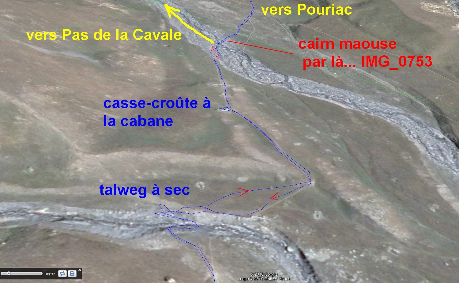
(273 KO) 1499 x 926 |
IMG_0755_ge2_diff voies.jpg @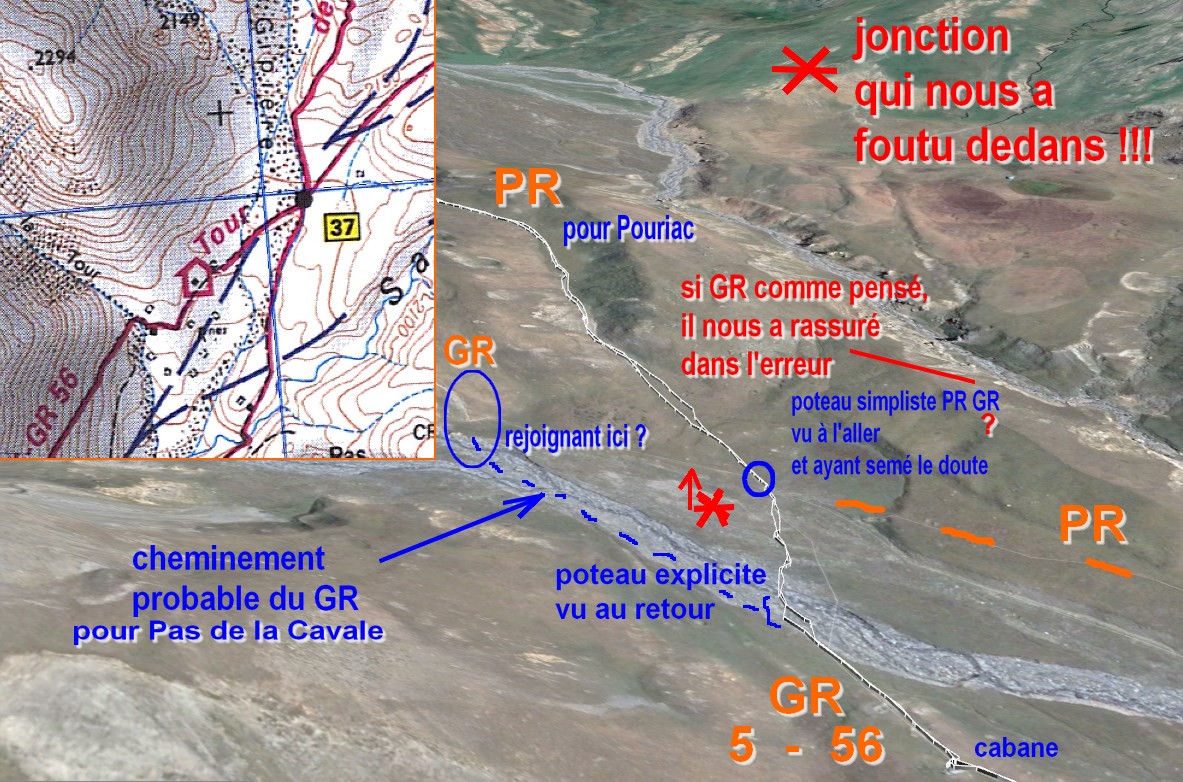
(340 KO) 1183 x 782 |
IMG_0755_ge3_retour de Cavale.jpg @
(240 KO) 1247 x 797 nous avons mal interprété le poteau "sommaire" et continué sur le PR, jaune à g. Les panneaux auraient dû être en cet endroit ! |
IMG_0755_ge4_Pas Cavale_trace.jpg @
(214 KO) 940 x 724 on aurait dû "jumeller" pour le voir ... |
IMG_0756_10h10.JPG
(3.74 MO) 3072 x 2304 |
IMG_0757_Pas par là.JPG
(3.81 MO) 3072 x 2304 |
IMG_0758.JPG
(4.01 MO) 3072 x 2304 |
IMG_0759.JPG
(4.1 MO) 3072 x 2304 |
IMG_0760.JPG
(4.13 MO) 3072 x 2304 |
IMG_0761.JPG
(4.12 MO) 3072 x 2304 |
IMG_0762.JPG
(3.94 MO) 3072 x 2304 |
IMG_0763.JPG
(3.99 MO) 3072 x 2304 |
IMG_0764.JPG
(3.97 MO) 3072 x 2304 |
IMG_0765.JPG
(3.13 MO) 3072 x 2304 le Col des Fourches |
IMG_0766_10h32.JPG
(3.16 MO) 3072 x 2304 notre approche n'en finit pas... ça nous interpelle |
IMG_0767.JPG
(3.25 MO) 3072 x 2304 |
IMG_0768.JPG
(3.61 MO) 3072 x 2304 |
IMG_0769.JPG
(3.71 MO) 3072 x 2304 |
IMG_0770.JPG
(3.94 MO) 3072 x 2304 |
IMG_0771.JPG
(3.13 MO) 3072 x 2304 |
IMG_0772.JPG
(3.58 MO) 3072 x 2304 |
IMG_0773.JPG
(3.1 MO) 3072 x 2304 |
IMG_0774.JPG
(2.91 MO) 3072 x 2304 |
IMG_0775.JPG
(2.92 MO) 3072 x 2304 |
IMG_0776.JPG
(3.67 MO) 3072 x 2304 |
IMG_0777.JPG
(4.27 MO) 3072 x 2304 petit torrent à sec |
IMG_0778.JPG
(4.21 MO) 3072 x 2304 |
IMG_0779.JPG
(4.32 MO) 3072 x 2304 je me repose en admirant ce beau bloc |
IMG_0780.JPG
(4.16 MO) 3072 x 2304 |
IMG_0781_10h35.JPG
(4.41 MO) 3072 x 2304 je ne prendrai aucune photo pendant la montée, jusqu'à mon arrêt perso dans le 90° gauche |
IMG_0782_11h26.JPG
(4.63 MO) 3072 x 2304 j'ai laissé JP se rendre au bout s'il veut, sa mission : gps et photos ... voici la première |
IMG_0783.JPG
(5.21 MO) 3072 x 2304 ce lac là n'est pas un des principaux, trop bas et loin de la trace |
IMG_0784_11h31.JPG
(5.13 MO) 3072 x 2304 il est au lac principal pas loin du col, et, plus près du col, il y en a un plus petit |
IMG_0785.JPG
(4.6 MO) 3072 x 2304 la fin est attirante et prometteuse |
IMG_0786_11h40.JPG
(4.98 MO) 3072 x 2304 là on voit lesdeux lacs : le moyen près du col et le plus gros, plus loin à d. ( quasi masqué ) |
IMG_0787.JPG
(5.54 MO) 3072 x 2304 de même ici |
IMG_0788.JPG
(3.98 MO) 3072 x 2304 1mn plus tard, il est au Col de Pouriac |
IMG_0789.JPG
(3.01 MO) 2304 x 3072 |
IMG_0790.JPG
(3.9 MO) 2304 x 3072 |
IMG_0791.JPG
(2.96 MO) 3072 x 2304 |
IMG_0792.JPG
(4.39 MO) 3072 x 2304 la descente est plus douce qu'au Pas escompté |
IMG_0793.JPG
(4.01 MO) 3072 x 2304 |
IMG_0794.JPG
(4.06 MO) 3072 x 2304 |
IMG_0795.JPG
(4.18 MO) 3072 x 2304 la Crête de Bourre à sa g. Ouest |
IMG_0796.JPG
(4.02 MO) 3072 x 2304 |
IMG_0797.JPG
(3.64 MO) 3072 x 2304 |
IMG_0798.JPG
(3.25 MO) 3072 x 2304 |
IMG_0799.JPG
(4.12 MO) 3072 x 2304 la Tête de Moïse en face |
IMG_0800.JPG
(4.66 MO) 3072 x 2304 |
IMG_0801.JPG
(4.12 MO) 3072 x 2304 la Baisse de Ferrière à sa d. Est |
IMG_0802.JPG
(4.05 MO) 3072 x 2304 |
IMG_0803.JPG
(4.49 MO) 3072 x 2304 |
IMG_0804.JPG
(4.61 MO) 3072 x 2304 |
IMG_0805.JPG
(4.27 MO) 3072 x 2304 |
IMG_0806.JPG
(4.36 MO) 3072 x 2304 |
IMG_0807.JPG
(4.04 MO) 3072 x 2304 |
IMG_0808.JPG
(3.61 MO) 3072 x 2304 |
IMG_0809.JPG
(4.03 MO) 3072 x 2304 de g. à d., la Crête de Bourre et le Rocher des Trois Evèques |
IMG_0810.JPG
(3.42 MO) 3072 x 2304 |
IMG_0811.JPG
(3.72 MO) 3072 x 2304 puis la Tête de l'Enchastraye |
IMG_0812.JPG
(3.73 MO) 3072 x 2304 |
IMG_0813.JPG
(3.6 MO) 3072 x 2304 |
IMG_0814.JPG
(3.06 MO) 3072 x 2304 |
IMG_0815.JPG
(3 MO) 3072 x 2304 |
IMG_0816.JPG
(3.17 MO) 3072 x 2304 |
IMG_0817.JPG
(2.86 MO) 3072 x 2304 la Tête de Moïse |
IMG_0818.JPG
(3.43 MO) 3072 x 2304 Tête de Vauclave puis Monte Scaletta à d. |
IMG_0819_11h50.JPG
(4.07 MO) 3072 x 2304 notre explorateur revient au grand lac |
IMG_0820.JPG
(3.4 MO) 3072 x 2304 |
IMG_0821.JPG
(3.5 MO) 3072 x 2304 |
IMG_0822.JPG
(3.71 MO) 3072 x 2304 |
IMG_0823.JPG
(3.98 MO) 3072 x 2304 |
IMG_0824.JPG
(3.14 MO) 3072 x 2304 |
IMG_0825.JPG
(3.73 MO) 3072 x 2304 --> sens trigo |
IMG_0826.JPG
(3.69 MO) 3072 x 2304 |
IMG_0827.JPG
(3.86 MO) 3072 x 2304 Crête des Terres Rouges |
IMG_0828.JPG
(3.75 MO) 3072 x 2304 |
IMG_0829.JPG
(4.51 MO) 3072 x 2304 |
IMG_0830.JPG
(5.01 MO) 3072 x 2304 |
IMG_0831_11h56.JPG
(4.7 MO) 3072 x 2304 le retour se poursuit |
IMG_0832.JPG
(4.84 MO) 3072 x 2304 |
IMG_0833.JPG
(3.9 MO) 3072 x 2304 une marmotte ? non, c'est moi qui guette son retour, là, au centre |
IMG_0834.JPG
(4.31 MO) 3072 x 2304 le plus petit lac entrevu et quasi à sec |
IMG_0835.JPG
(5.02 MO) 3072 x 2304 elle ne risque rien ....... on a nos provisions. Dès le retour de JP, repas et sieste, à l'abri du vent |
IMG_0836_13h29.JPG
(2.86 MO) 3072 x 2304 JP dort déjà, quelques photos avant ma sieste, vers Pelousette... et sens horaire sans zoom |
IMG_0837.JPG
(3.67 MO) 3072 x 2304 |
IMG_0838.JPG
(3.48 MO) 3072 x 2304 vers le Pas de la Cavale |
IMG_0839.JPG
(3.59 MO) 3072 x 2304 le Rocher des Trois Evèques |
IMG_0840.JPG
(3.43 MO) 3072 x 2304 la Crête de Bourre |
IMG_0841.JPG
(3.46 MO) 3072 x 2304 la Baisse de Ferrière ... --> sens horaire |
IMG_0842.JPG
(4.02 MO) 3072 x 2304 |
IMG_0843.JPG
(3.48 MO) 3072 x 2304 Mont Aiga ? |
IMG_0844.JPG
(3.85 MO) 3072 x 2304 |
IMG_0845.JPG
(3.31 MO) 3072 x 2304 Tête des Mourres ? |
IMG_0846.JPG
(5.16 MO) 3072 x 2304 |
IMG_0847.JPG
(3.33 MO) 3072 x 2304 |
IMG_0848.JPG
(3.04 MO) 3072 x 2304 |
IMG_0849.JPG
(2.94 MO) 3072 x 2304 |
IMG_0850.JPG
(2.97 MO) 3072 x 2304 |
IMG_0851.JPG
(3.04 MO) 3072 x 2304 |
IMG_0852.JPG
(3.55 MO) 3072 x 2304 puis quelques zooms |
IMG_0853.JPG
(3.18 MO) 3072 x 2304 la remontée au Col des Fourches |
IMG_0854.JPG
(3.19 MO) 3072 x 2304 et le Col des Fourches |
IMG_0855.JPG
(2.32 MO) 3072 x 2304 je manque de repère, je dirai Serre de la Braissa |
IMG_0856.JPG
(2.32 MO) 3072 x 2304 |
IMG_0857.JPG
(2.39 MO) 3072 x 2304 je dirai, à coup sûr, Fort Carra au centre au fond |
IMG_0858.JPG
(2.27 MO) 3072 x 2304 |
IMG_0859_13h34.JPG
(2.68 MO) 3072 x 2304 Bonnet Carré à g. |
IMG_0860.JPG
(1.35 MO) 3072 x 2304 non ce n'est pas un humain, là-haut ! |
IMG_0861_13h36.JPG
(1.54 MO) 3072 x 2304 |
IMG_0862.JPG
(1.52 MO) 3072 x 2304 ici non plus d'ailleurs ! |
IMG_0863_14h46.JPG
(5.3 MO) 3072 x 2304 première photo du retour, en coupant un peu |
IMG_0864.JPG
(4.52 MO) 3072 x 2304 |
IMG_0865_14h50.JPG
(4.02 MO) 3072 x 2304 ça va être la course avec les moutons... |
IMG_0866_14h59.JPG
(4.29 MO) 3072 x 2304 |
IMG_0867.JPG
(3.92 MO) 3072 x 2304 |
IMG_0868.JPG
(3.95 MO) 3072 x 2304 |
IMG_0869_15h07.JPG
(2.94 MO) 3072 x 2304 les moutons vont être plus rapides que moi, je vais les laisser passer, on va les retrouver à la cabane |
IMG_0870_15h11.JPG
(3.6 MO) 3072 x 2304 je regarde vers Pouriac |
IMG_0871.JPG
(3.66 MO) 3072 x 2304 |
IMG_0872_16h07.JPG
(3.94 MO) 3072 x 2304 les moutons ont franchi le torrent à sec et repartent vers leur bergerie, le grand départ sera dans 3 jours... |
IMG_0873.JPG
(4.16 MO) 3072 x 2304 |
IMG_0874.JPG
(2.94 MO) 3072 x 2304 le Pas de la Cavale se fait dans la partie herbeuse à gauche, sauf à la fin |
IMG_0875_16h26.JPG
(3.16 MO) 3072 x 2304 ... pendant la pénible remontée ... |
IMG_0876.JPG
(3.23 MO) 3072 x 2304 |
IMG_0877.JPG
(2.49 MO) 3072 x 2304 l'espoir renait |
IMG_0878_16h31.JPG
(3.02 MO) 3072 x 2304 |
IMG_0879.JPG
(3.34 MO) 3072 x 2304 |
IMG_0880.JPG
(3.17 MO) 3072 x 2304 |
IMG_0881_16h35.JPG
(3.24 MO) 3072 x 2304 |
IMG_0882.JPG
(3.43 MO) 3072 x 2304 |
IMG_0883.JPG
(3.6 MO) 3072 x 2304 |
IMG_0884.JPG
(4.02 MO) 3072 x 2304 |
IMG_0885_16h54.JPG
(3.9 MO) 3072 x 2304 le PR qui part vers la Cime de Pelousette ( en me retournant ) |
IMG_0886.JPG
(4.62 MO) 3072 x 2304 et le "bien bénit" parking ... OUF |
virtuel 360° du Pas de la Cavale @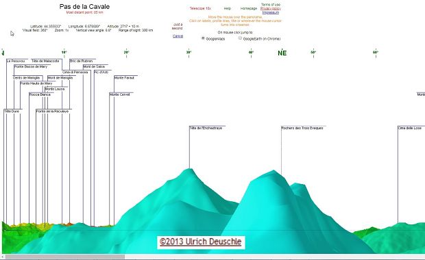
(144 KO) 1535 x 943 |
virtuel 360° du Col de Pouriac + 100m au-dessus @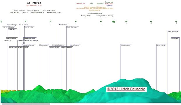
(155 KO) 1622 x 944 |
virtuel 360° du Col de Pouriac plus 10m, la norme @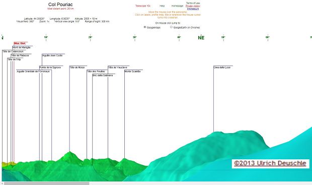
(127 KO) 1584 x 938 |
début de trace @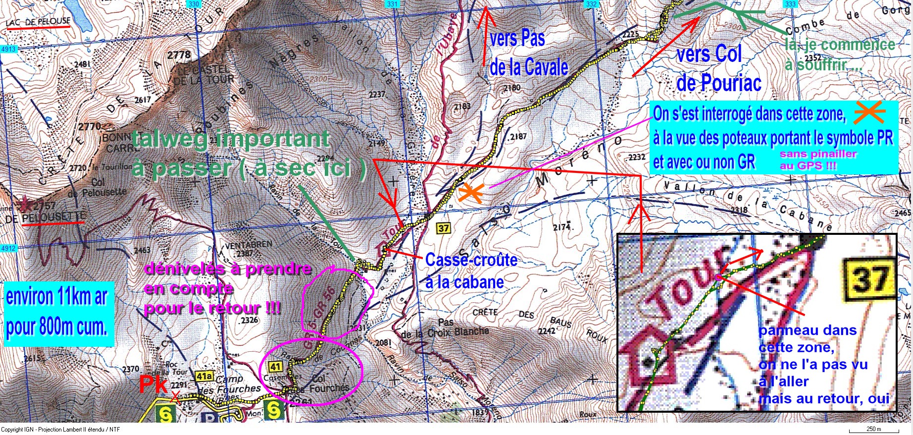
(1004 KO) 1844 x 878 |
fin de trace @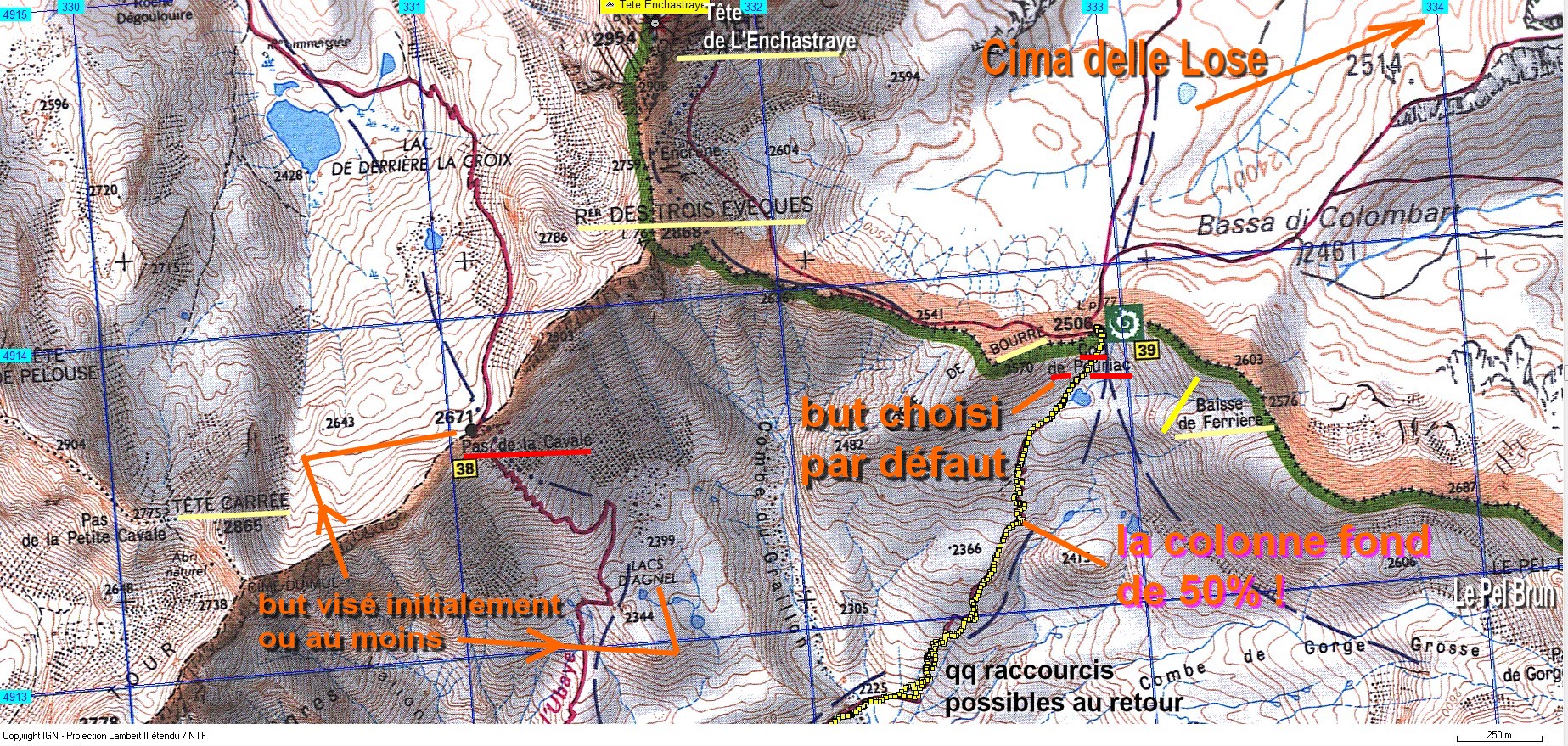
(1018 KO) 1847 x 879 bien que assez dure pour moi, cela a été plus facile que le Pas de la Cavale initialement prévu |
Baisse de Ferrière et Tête des Mourres vers Vens @
(292 KO) 1607 x 842 |
Crête de Bourre et Rocherer des Trois Evèques @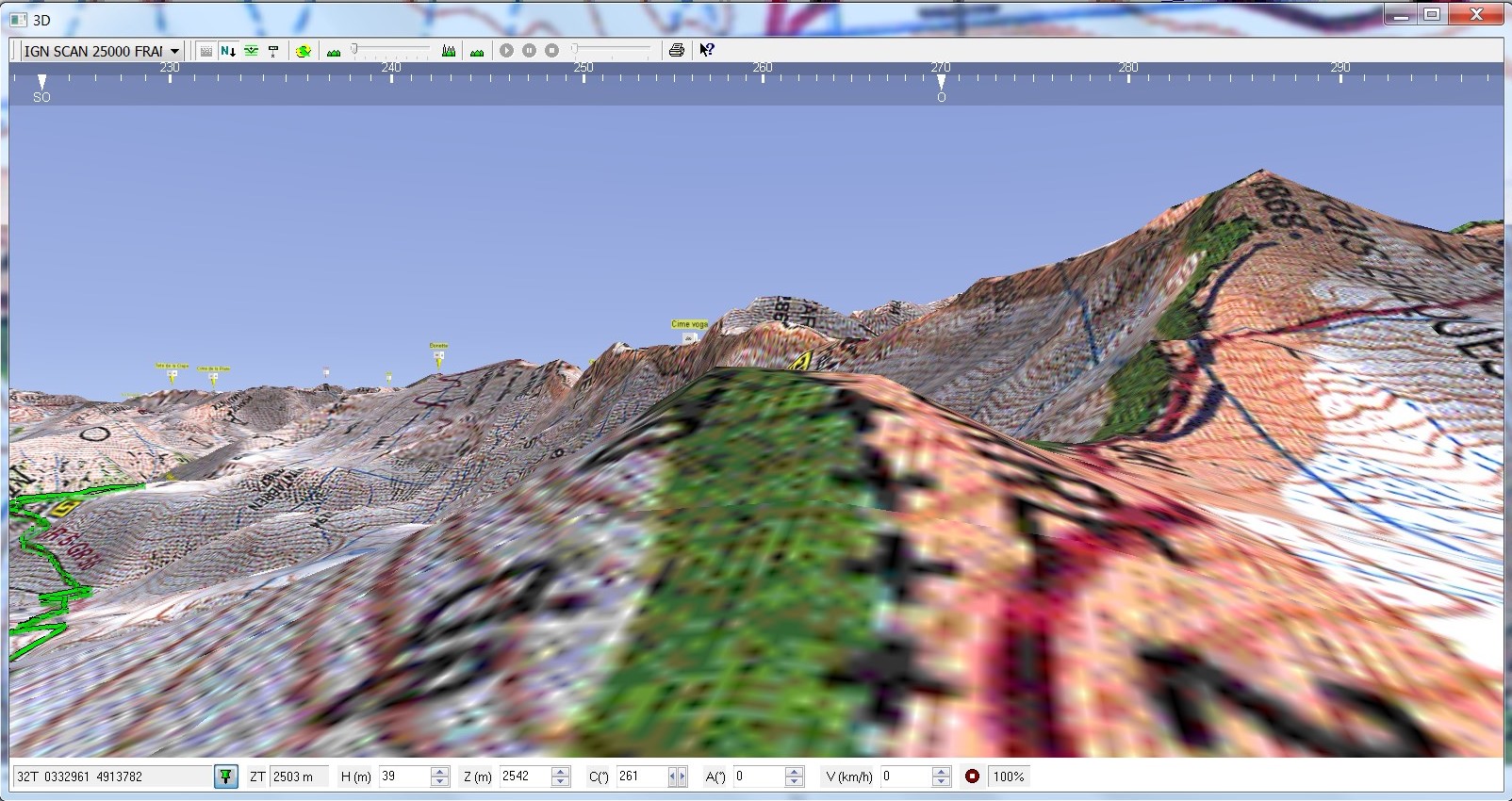
(343 KO) 1604 x 850 |
Pouriac plus 400m en Carto Explorer @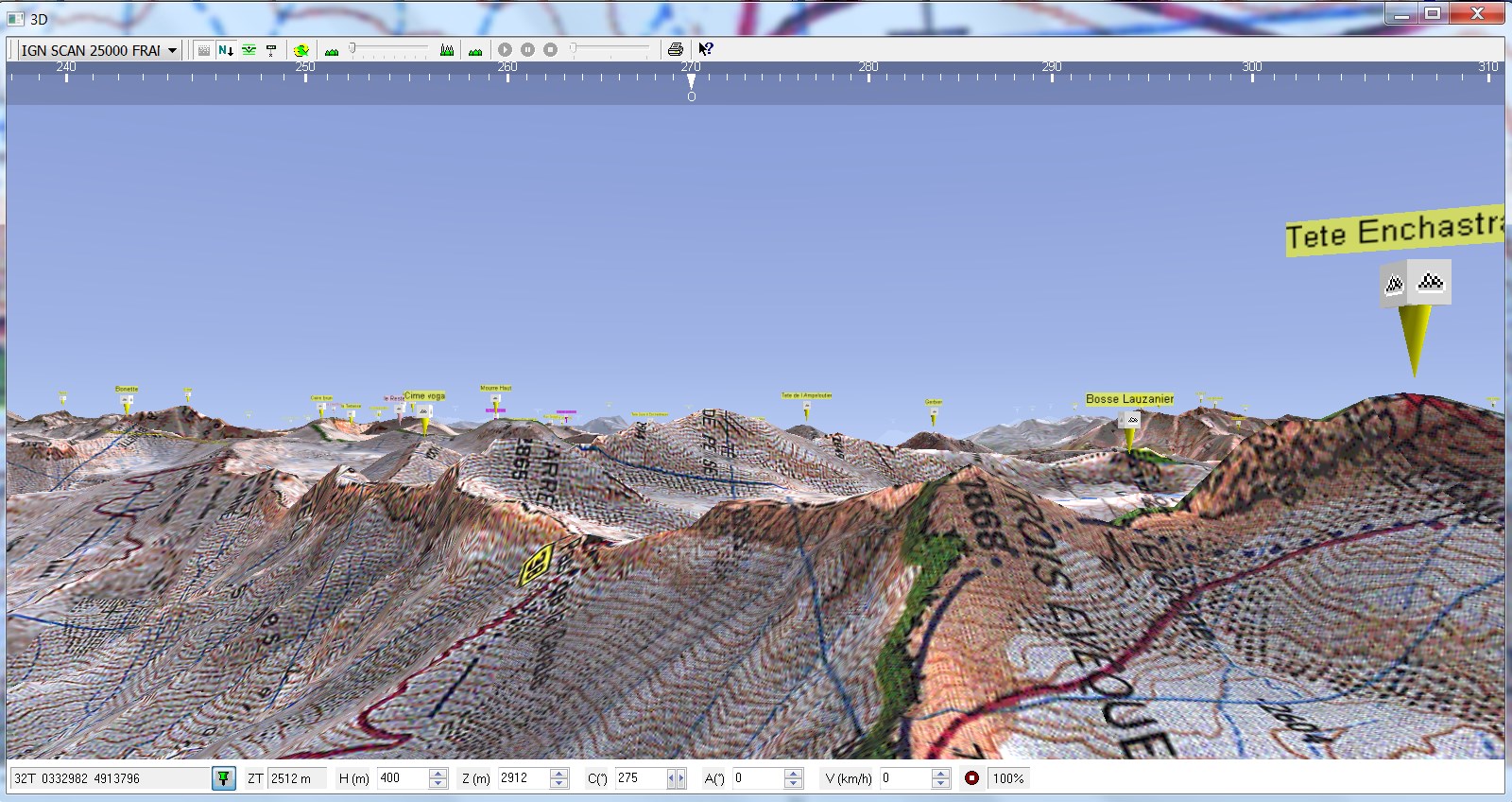
(365 KO) 1600 x 848 |
S S-O @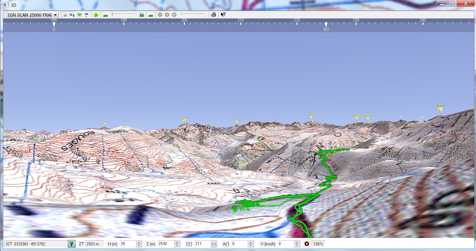
(332 KO) 1602 x 844 |
Tête de M oïse et Cima delle Lose et Baisse de Ferrière @
(226 KO) 1608 x 851 |
Tête de Moïse et Cima Delle Lose @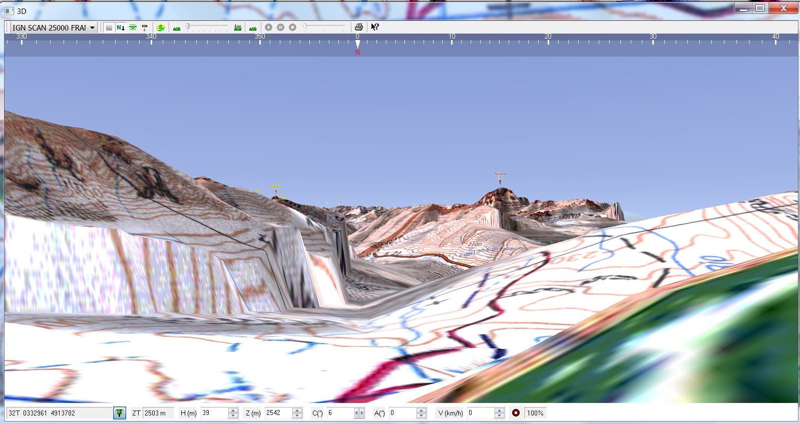
(270 KO) 1598 x 847 |
Tête des Mourres Terres Rouges @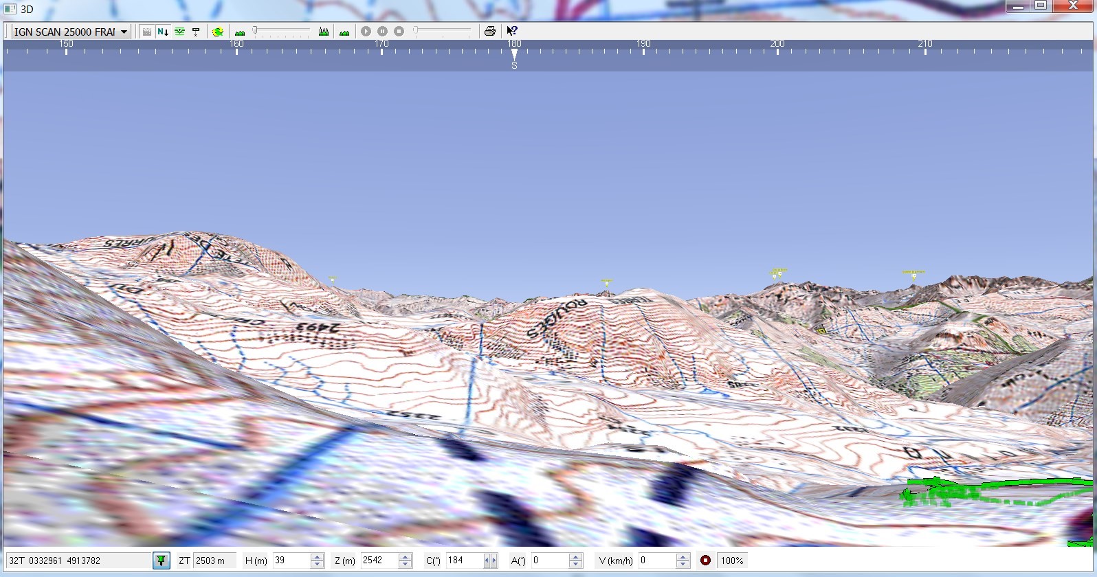
(313 KO) 1596 x 840 |
|
|
|
|
Copyright © 2019 par bnbd05
Tous droits réservés |
|
 _Guest book